Alleghe geodata
Alleghe (Veneto) is a seat of a third-order administrative division; located in Italy in Europe/Rome (GMT+2) time zone. With population of 656 people, there are 8593 cities with bigger population in this country. Compared to other cities in Italy, 97.7% of cities are located further ↓South; 56.2% of cities are located further ←West and 97.3% of cities have lower elevation than Alleghe. Note1


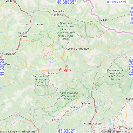
Alleghe GPS coordinates[2]
46° 24' 25.848" North, 12° 1' 24.096" East
| Map corner | latitude | longitude |
|---|---|---|
| Upper-left | 46.88985°, | 11.32024° |
| Center: | 46.40718°, | 12.02336° |
| Lower-right: | 45.9202°, | 12.72649° |
| Map W x H: | 107.8×107.8 km | = 67×67mi |
| max Lat: | 47.04031° ⇑2.3% North |
| Alleghe: | 46.40718° |
| min Lat: | ⇓97.7% South 35.50142° |
| min Long | Alleghe | max Long |
| 6.69888° | 12.02336° | 18.48682° |
| W 56.2%⇐ | ⇒43.8% E |
Elevation
Elevation of Alleghe is 1029 m = 3376 ft, and this is 722.3 m = 2370 ft above average elevation for this country.
| Max E: |
2085 m = 6841 ft | 2.7% |
| Alleghe | 1029 m 3376 ft | |
| Avg. | 306.7 m = 1006 ft | |
Min E: |
-4 m = -13 ft | 97.3% |
See also: Italy elevation on elevation.city.
Geographical zone
Alleghe is located in North temperate zone (between Tropic of Cancer and the Arctic Circle). Distance of this North polar circle is 2241.2 km =1392.6 mi to North.| Distance of | km | miles | from Alleghe |
|---|---|---|---|
| North Pole | 4847.1 | 3011.8 | to North |
| Arctic Circle | 2241.2 | 1392.6 | to North |
| Tropic Cancer | 2554.1 | 1587 | to South |
| Equator | 5160 | 3206.3 | to South |


Nearby cities:
15 places around Alleghe: (largest is in red/bold)
• Bortolot
11.8 km =7.3 mi,  101°
101°
• Canale d'Agordo
10.1 km =6.3 mi,  236°
236°
• Caviola
10.8 km =6.7 mi, 243°
• Celat-San Tomaso Agordino
4.8 km =3 mi,  231°
231°
• Cencenighe Agordino
7.5 km =4.7 mi,  214°
214°
• Colle Santa Lucia
4.7 km =2.9 mi,  351°
351°
• Fusine
8.6 km =5.3 mi,  113°
113°
• Livinallongo del Col di Lana
9.8 km =6.1 mi,  327°
327°
• Rocca Pietore
4.6 km =2.9 mi,  309°
309°
• Sachet
8.2 km =5.1 mi, 239°
• Selva di Cadore
5.4 km =3.4 mi,  28°
28°
• Taibon Agordino
12.1 km =7.5 mi,  183°
183°
• Vallada Agordina
8.3 km =5.2 mi, 235°
• Zoldo Alto
8.7 km =5.4 mi, 113°
• Zoppè di Cadore
11.8 km =7.3 mi, 101°
Sources, notices
• [Note1] Compared only with cities in Italy existing in our database
• [Src1] Map data: © OpenStreetMap contributors (CC-BY-SA)
• [Src2] Other city data from geonames.org with taken over terms of usage.
• [Src3] Geographical zone / Annual Mean Temperature by Robert A. Rohde @ Wikipedia
