Alba-Penia geodata
Alba-Penia (Trentino-Alto Adige) is a populated place; located in Italy in Europe/Rome (GMT+2) time zone. With population of 863 people, there are 7351 cities with bigger population in this country. Compared to other cities in Italy, 98.1% of cities are located further ↓South; 53.1% of cities are located further ←West and 99.7% of cities have lower elevation than Alba-Penia. Note1
Administrative division(s):
- Level 1: Trentino-Alto Adige
- Level 2: Provincia autonoma di Trento
- Level 3: Canazei


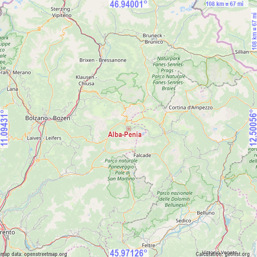
Alba-Penia GPS coordinates[2]
46° 27' 28.044" North, 11° 47' 50.748" East
| Map corner | latitude | longitude |
|---|---|---|
| Upper-left | 46.94001°, | 11.09431° |
| Center: | 46.45779°, | 11.79743° |
| Lower-right: | 45.97126°, | 12.50056° |
| Map W x H: | 107.7×107.7 km | = 66.9×66.9mi |
| max Lat: | 47.04031° ⇑1.9% North |
| Alba-Penia: | 46.45779° |
| min Lat: | ⇓98.1% South 35.50142° |
| min Long | Alba-Penia | max Long |
| 6.69888° | 11.79743° | 18.48682° |
| W 53.1%⇐ | ⇒46.9% E |
Elevation
Elevation of Alba-Penia is 1532 m = 5026 ft, and this is 1225.3 m = 4020 ft above average elevation for this country.
| Max E: |
2085 m = 6841 ft | 0.3% |
| Alba-Penia | 1532 m 5026 ft | |
| Avg. | 306.7 m = 1006 ft | |
Min E: |
-4 m = -13 ft | 99.7% |
See also: Italy elevation on elevation.city.
Geographical zone
Alba-Penia is located in North temperate zone (between Tropic of Cancer and the Arctic Circle). Distance of this North polar circle is 2235.6 km =1389.1 mi to North.| Distance of | km | miles | from Alba-Penia |
|---|---|---|---|
| North Pole | 4841.4 | 3008.3 | to North |
| Arctic Circle | 2235.6 | 1389.1 | to North |
| Tropic Cancer | 2559.7 | 1590.5 | to South |
| Equator | 5165.6 | 3209.8 | to South |


Nearby cities:
15 places around Alba-Penia: (largest is in red/bold)
• Campitello di Fassa
4.8 km =3 mi,  294°
294°
• Canazei
3 km =1.9 mi,  313°
313°
• Caviola
12.9 km =8 mi,  143°
143°
• Corvara in Badia
11.8 km =7.3 mi,  29°
29°
• Falcade Alto
12.3 km =7.6 mi,  158°
158°
• Livinallongo del Col di Lana
12.3 km =7.6 mi,  77°
77°
• Mazzin
7.4 km =4.6 mi,  269°
269°
• Moena
13.9 km =8.6 mi,  229°
229°
• Pera
8.2 km =5.1 mi,  256°
256°
• Pie' Falcade
12.6 km =7.8 mi,  153°
153°
• Pozza di Fassa
9.1 km =5.7 mi,  248°
248°
• Santa Cristina Valgardena
12.7 km =7.9 mi,  336°
336°
• Selva
11.1 km =6.9 mi,  345°
345°
• Soraga
12.3 km =7.6 mi,  235°
235°
• Vigo di Fassa
10.4 km =6.5 mi, 245°
Sources, notices
• [Note1] Compared only with cities in Italy existing in our database
• [Src1] Map data: © OpenStreetMap contributors (CC-BY-SA)
• [Src2] Other city data from geonames.org with taken over terms of usage.
• [Src3] Geographical zone / Annual Mean Temperature by Robert A. Rohde @ Wikipedia
