Trafinello I geodata
Trafinello I (Calabria) is a populated place; located in Italy in Europe/Rome (GMT+2) time zone. With population of 589 people, there are 9105 cities with bigger population in this country. Compared to other cities in Italy, 92.4% of cities are located further ↑North; 98.1% of cities are located further ←West and 84.1% of cities have higher elevation than Trafinello I. Note1


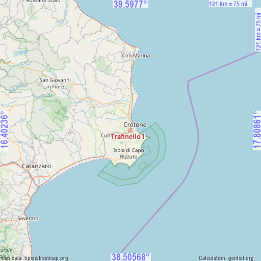
Trafinello I GPS coordinates[2]
39° 3' 13.68" North, 17° 6' 19.728" East
| Map corner | latitude | longitude |
|---|---|---|
| Upper-left | 39.5977°, | 16.40236° |
| Center: | 39.0538°, | 17.10548° |
| Lower-right: | 38.50568°, | 17.80861° |
| Map W x H: | 121.4×121.4 km | = 75.4×75.4mi |
| max Lat: | 47.04031° ⇑92.4% North |
| Trafinello I: | 39.0538° |
| min Lat: | ⇓7.6% South 35.50142° |
| min Long | Trafinello I | max Long |
| 6.69888° | 17.10548° | 18.48682° |
| W 98.1%⇐ | ⇒1.9% E |
Elevation
Elevation of Trafinello I is 34 m = 112 ft, and this is 272.7 m = 895 ft below average elevation for this country.
| Max E: |
2085 m = 6841 ft | 84.1% |
| Avg. | 306.7 m = 1006 ft | |
| Trafinello I | 34 m = 112 ft | |
Min E: |
-4 m = -13 ft | 15.9% |
See also: Italy elevation on elevation.city.
Geographical zone
Trafinello I is located in North temperate zone (between Tropic of Cancer and the Arctic Circle). Distance of this Northern Tropic circle is 1736.5 km =1079 mi to South.| Distance of | km | miles | from Trafinello I |
|---|---|---|---|
| North Pole | 5664.7 | 3519.9 | to North |
| Arctic Circle | 3058.8 | 1900.6 | to North |
| Tropic Cancer | 1736.5 | 1079 | to South |
| Equator | 4342.4 | 2698.2 | to South |


Nearby cities:
15 places around Trafinello I: (largest is in red/bold)
• Capo Rizzuto
16.7 km =10.4 mi,  182°
182°
• Contrada Sant'Anna Iv
6.7 km =4.2 mi,  207°
207°
• Crotone
3.6 km =2.2 mi,  32°
32°
• Cutro
10.5 km =6.5 mi,  258°
258°
• Farina IV
1.5 km =0.9 mi,  162°
162°
• Isola di Capo Rizzuto
10.7 km =6.6 mi,  186°
186°
• Le Castella
17.5 km =10.9 mi,  204°
204°
• Papanice
7 km =4.3 mi,  285°
285°
• Rocca di Neto
16.7 km =10.4 mi,  329°
329°
• Roccabernarda
22.9 km =14.2 mi, 292°
• San Leonardo di Cutro
15.6 km =9.7 mi,  223°
223°
• San Mauro Marchesato
16.6 km =10.3 mi, 290°
• Santa Severina
19.8 km =12.3 mi,  301°
301°
• Scandale
14.6 km =9.1 mi, 301°
• Tronca
21.4 km =13.3 mi,  0°
0°
Sources, notices
• [Note1] Compared only with cities in Italy existing in our database
• [Src1] Map data: © OpenStreetMap contributors (CC-BY-SA)
• [Src2] Other city data from geonames.org with taken over terms of usage.
• [Src3] Geographical zone / Annual Mean Temperature by Robert A. Rohde @ Wikipedia
