Roccabernarda geodata
Roccabernarda (Calabria) is a seat of a third-order administrative division; located in Italy in Europe/Rome (GMT+2) time zone. With population of 3,316 people, there are 2825 cities with bigger population in this country. Compared to other cities in Italy, 92.1% of cities are located further ↑North; 97.7% of cities are located further ←West and 62.3% of cities have higher elevation than Roccabernarda. Note1


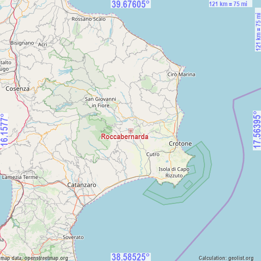
Roccabernarda GPS coordinates[2]
39° 7' 57.936" North, 16° 51' 38.952" East
| Map corner | latitude | longitude |
|---|---|---|
| Upper-left | 39.67605°, | 16.1577° |
| Center: | 39.13276°, | 16.86082° |
| Lower-right: | 38.58525°, | 17.56395° |
| Map W x H: | 121.3×121.3 km | = 75.4×75.4mi |
| max Lat: | 47.04031° ⇑92.1% North |
| Roccabernarda: | 39.13276° |
| min Lat: | ⇓7.9% South 35.50142° |
| min Long | Roccabernarda | max Long |
| 6.69888° | 16.86082° | 18.48682° |
| W 97.7%⇐ | ⇒2.3% E |
Elevation
Elevation of Roccabernarda is 147 m = 482 ft, and this is 159.7 m = 524 ft below average elevation for this country.
| Max E: |
2085 m = 6841 ft | 62.3% |
| Avg. | 306.7 m = 1006 ft | |
| Roccabernarda | 147 m = 482 ft | |
Min E: |
-4 m = -13 ft | 37.7% |
See also: Italy elevation on elevation.city.
Geographical zone
Roccabernarda is located in North temperate zone (between Tropic of Cancer and the Arctic Circle). Distance of this Northern Tropic circle is 1745.2 km =1084.4 mi to South.| Distance of | km | miles | from Roccabernarda |
|---|---|---|---|
| North Pole | 5655.9 | 3514.4 | to North |
| Arctic Circle | 3050 | 1895.2 | to North |
| Tropic Cancer | 1745.2 | 1084.4 | to South |
| Equator | 4351.2 | 2703.7 | to South |


Nearby cities:
15 places around Roccabernarda: (largest is in red/bold)
• Belcastro
14.3 km =8.9 mi,  206°
206°
• Belvedere Spinello
8.7 km =5.4 mi,  18°
18°
• Caccuri
12.6 km =7.8 mi,  325°
325°
• Cerenzia
14 km =8.7 mi, 333°
• Cotronei
7.8 km =4.8 mi,  292°
292°
• Foresta
5.6 km =3.5 mi,  228°
228°
• Marcedusa
12 km =7.5 mi,  190°
190°
• Mesoraca
8.6 km =5.3 mi, 226°
• Pagliarelle
9.5 km =5.9 mi,  274°
274°
• Petilia Policastro
7.2 km =4.5 mi,  252°
252°
• Petronà
13.3 km =8.3 mi,  221°
221°
• Rocca di Neto
13.8 km =8.6 mi,  66°
66°
• San Mauro Marchesato
6.4 km =4 mi,  118°
118°
• Santa Severina
4.6 km =2.9 mi, 69°
• Scandale
8.8 km =5.5 mi,  96°
96°
Sources, notices
• [Note1] Compared only with cities in Italy existing in our database
• [Src1] Map data: © OpenStreetMap contributors (CC-BY-SA)
• [Src2] Other city data from geonames.org with taken over terms of usage.
• [Src3] Geographical zone / Annual Mean Temperature by Robert A. Rohde @ Wikipedia
