Vilminore geodata
Vilminore (Lombardy) is a seat of a third-order administrative division; located in Italy in Europe/Rome (GMT+2) time zone. With population of 610 people, there are 8915 cities with bigger population in this country. Compared to other cities in Italy, 91.9% of cities are located further ↓South; 67% of cities are located further →East and 97.4% of cities have lower elevation than Vilminore. Note1
Administrative division(s):
- Level 1: Lombardy
- Level 2: Provincia di Bergamo
- Level 3: Vilminore di Scalve


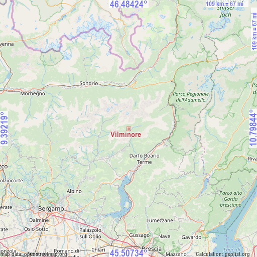
Vilminore GPS coordinates[2]
45° 59' 52.62" North, 10° 5' 43.116" East
| Map corner | latitude | longitude |
|---|---|---|
| Upper-left | 46.48424°, | 9.39219° |
| Center: | 45.99795°, | 10.09531° |
| Lower-right: | 45.50734°, | 10.79844° |
| Map W x H: | 108.6×108.6 km | = 67.5×67.5mi |
| max Lat: | 47.04031° ⇑8.1% North |
| Vilminore: | 45.99795° |
| min Lat: | ⇓91.9% South 35.50142° |
| min Long | Vilminore | max Long |
| 6.69888° | 10.09531° | 18.48682° |
| W 33%⇐ | ⇒67% E |
Elevation
Elevation of Vilminore is 1032 m = 3386 ft, and this is 725.3 m = 2380 ft above average elevation for this country.
| Max E: |
2085 m = 6841 ft | 2.6% |
| Vilminore | 1032 m 3386 ft | |
| Avg. | 306.7 m = 1006 ft | |
Min E: |
-4 m = -13 ft | 97.4% |
See also: Italy elevation on elevation.city.
Geographical zone
Vilminore is located in North temperate zone (between Tropic of Cancer and the Arctic Circle). Distance of this North polar circle is 2286.7 km =1420.9 mi to North.| Distance of | km | miles | from Vilminore |
|---|---|---|---|
| North Pole | 4892.6 | 3040.1 | to North |
| Arctic Circle | 2286.7 | 1420.9 | to North |
| Tropic Cancer | 2508.6 | 1558.8 | to South |
| Equator | 5114.5 | 3178 | to South |


Nearby cities:
15 places around Vilminore: (largest is in red/bold)
• Angolo Terme
12.5 km =7.8 mi,  160°
160°
• Azzone
2.5 km =1.6 mi,  147°
147°
• Bondione
7.9 km =4.9 mi,  301°
301°
• Borno
10 km =6.2 mi,  124°
124°
• Castione della Presolana
9.8 km =6.1 mi,  198°
198°
• Colere
2.7 km =1.7 mi, 199°
• Gandellino
11.5 km =7.1 mi,  266°
266°
• Gromo
13.7 km =8.5 mi,  252°
252°
• Lozio
12.9 km =8 mi,  96°
96°
• Onore
13.5 km =8.4 mi,  208°
208°
• Ossimo Inferiore
12.5 km =7.8 mi, 119°
• Ossimo Superiore
11.9 km =7.4 mi, 118°
• Piamborno
13.3 km =8.3 mi,  130°
130°
• Schilpario
4.8 km =3 mi,  75°
75°
• Vilminore di Scalve
0.1 km =0.1 mi,  282°
282°
Sources, notices
• [Note1] Compared only with cities in Italy existing in our database
• [Src1] Map data: © OpenStreetMap contributors (CC-BY-SA)
• [Src2] Other city data from geonames.org with taken over terms of usage.
• [Src3] Geographical zone / Annual Mean Temperature by Robert A. Rohde @ Wikipedia
