Bondione geodata
Bondione (Lombardy) is a seat of a third-order administrative division; located in Italy in Europe/Rome (GMT+2) time zone. With population of 619 people, there are 8850 cities with bigger population in this country. Compared to other cities in Italy, 92.7% of cities are located further ↓South; 67.7% of cities are located further →East and 95.7% of cities have lower elevation than Bondione. Note1


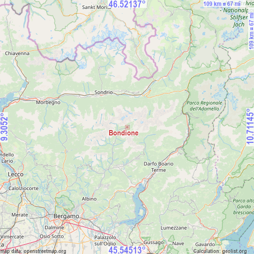
Bondione GPS coordinates[2]
46° 2' 7.476" North, 10° 0' 29.952" East
| Map corner | latitude | longitude |
|---|---|---|
| Upper-left | 46.52137°, | 9.3052° |
| Center: | 46.03541°, | 10.00832° |
| Lower-right: | 45.54513°, | 10.71145° |
| Map W x H: | 108.5×108.5 km | = 67.4×67.4mi |
| max Lat: | 47.04031° ⇑7.3% North |
| Bondione: | 46.03541° |
| min Lat: | ⇓92.7% South 35.50142° |
| min Long | Bondione | max Long |
| 6.69888° | 10.00832° | 18.48682° |
| W 32.3%⇐ | ⇒67.7% E |
Elevation
Elevation of Bondione is 913 m = 2995 ft, and this is 606.3 m = 1989 ft above average elevation for this country.
| Max E: |
2085 m = 6841 ft | 4.3% |
| Bondione | 913 m 2995 ft | |
| Avg. | 306.7 m = 1006 ft | |
Min E: |
-4 m = -13 ft | 95.7% |
See also: Italy elevation on elevation.city.
Geographical zone
Bondione is located in North temperate zone (between Tropic of Cancer and the Arctic Circle). Distance of this North polar circle is 2282.5 km =1418.3 mi to North.| Distance of | km | miles | from Bondione |
|---|---|---|---|
| North Pole | 4888.4 | 3037.5 | to North |
| Arctic Circle | 2282.5 | 1418.3 | to North |
| Tropic Cancer | 2512.7 | 1561.3 | to South |
| Equator | 5118.7 | 3180.6 | to South |


Nearby cities:
15 places around Bondione: (largest is in red/bold)
• Ardesio
12.6 km =7.8 mi,  208°
208°
• Azzone
10.2 km =6.3 mi,  127°
127°
• Boffetto
14.5 km =9 mi,  343°
343°
• Castello dell'Acqua
12.3 km =7.6 mi,  2°
2°
• Castione della Presolana
13.9 km =8.6 mi,  164°
164°
• Chiuro
14.8 km =9.2 mi,  353°
353°
• Colere
8.9 km =5.5 mi,  139°
139°
• Gandellino
6.9 km =4.3 mi,  224°
224°
• Gromo
10.3 km =6.4 mi, 217°
• Oltressenda Alta
14.2 km =8.8 mi,  200°
200°
• San Giacomo
13.9 km =8.6 mi,  5°
5°
• Schilpario
11.7 km =7.3 mi,  104°
104°
• Valgoglio
9.9 km =6.2 mi,  227°
227°
• Vilminore
7.9 km =4.9 mi,  121°
121°
• Vilminore di Scalve
7.8 km =4.8 mi, 122°
Sources, notices
• [Note1] Compared only with cities in Italy existing in our database
• [Src1] Map data: © OpenStreetMap contributors (CC-BY-SA)
• [Src2] Other city data from geonames.org with taken over terms of usage.
• [Src3] Geographical zone / Annual Mean Temperature by Robert A. Rohde @ Wikipedia
