Safi geodata
Safi (Karak) is a populated place; located in Jordan in Asia/Amman (GMT+3) time zone. With population of 15,200 people, there are 26 cities with bigger population in this country. Compared to other cities in Jordan, 87% of cities are located further ↑North; 97.1% of cities are located further →East and 100% of cities have higher elevation than Safi. Note1


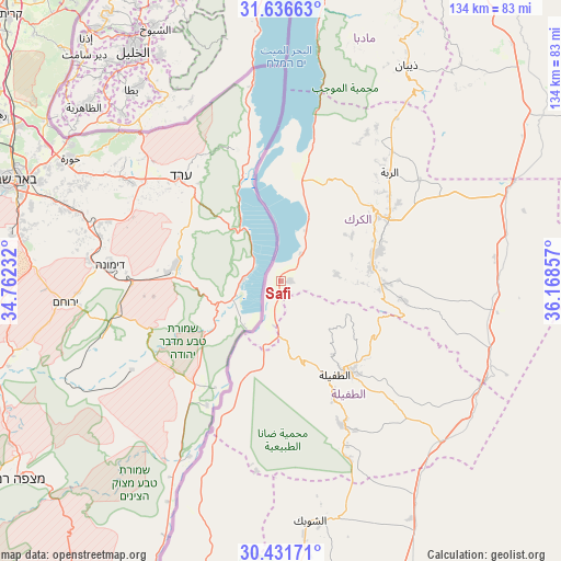
Safi GPS coordinates[2]
31° 2' 9.888" North, 35° 27' 55.584" East
| Map corner | latitude | longitude |
|---|---|---|
| Upper-left | 31.63663°, | 34.76232° |
| Center: | 31.03608°, | 35.46544° |
| Lower-right: | 30.43171°, | 36.16857° |
| Map W x H: | 134×134 km | = 83.3×83.3mi |
| max Lat: | 33.31405° ⇑87% North |
| Safi: | 31.03608° |
| min Lat: | ⇓13% South 29.40842° |
| min Long | Safi | max Long |
| 34.97918° | 35.46544° | 38.70342° |
| W 2.9%⇐ | ⇒97.1% E |
Elevation
Elevation of Safi is -366 m = -1201 ft, and this is 1051.7 m = 3450 ft below average elevation for this country.
| Max E: |
1440 m = 4724 ft | 100% |
| Avg. | 685.7 m = 2250 ft | |
| Safi | -366 m = -1201 ft | |
Min E: |
-366 m = -1201 ft | 0% |
See also: Jordan elevation on elevation.city.
Geographical zone
Safi is located in North temperate zone (between Tropic of Cancer and the Arctic Circle). Distance of this Northern Tropic circle is 845 km =525.1 mi to South.| Distance of | km | miles | from Safi |
|---|---|---|---|
| North Pole | 6556.2 | 4073.8 | to North |
| Arctic Circle | 3950.3 | 2454.6 | to North |
| Tropic Cancer | 845 | 525.1 | to South |
| Equator | 3450.9 | 2144.3 | to South |


Nearby cities:
15 places around Safi: (largest is in red/bold)
• Adir
33.7 km =20.9 mi,  56°
56°
• Al Khinzīrah
13.5 km =8.4 mi,  83°
83°
• Al Mazār al Janūbī
22.1 km =13.7 mi, 80°
• Al Mughayyir
50.4 km =31.3 mi,  35°
35°
• Al Qaşr
40.7 km =25.3 mi, 40°
• Al Ḩusaynīyah
24.6 km =15.3 mi,  92°
92°
• Ar Rabbah
36.7 km =22.8 mi,  45°
45°
• Aţ Ţafīlah
25.8 km =16 mi,  149°
149°
• Buşayrā
36.4 km =22.6 mi,  157°
157°
• Fuqū‘
43.2 km =26.8 mi,  31°
31°
• Ghawr al Mazra‘ah
26 km =16.2 mi,  10°
10°
• Karak City
31.6 km =19.6 mi, 63°
• Qīr Moāv
27.6 km =17.1 mi, 53°
• ‘Ayy
20.2 km =12.6 mi, 57°
• ‘Izrā
25.6 km =15.9 mi, 57°
Sources, notices
• [Note1] Compared only with cities in Jordan existing in our database
• [Src1] Map data: © OpenStreetMap contributors (CC-BY-SA)
• [Src2] Other city data from geonames.org with taken over terms of usage.
• [Src3] Geographical zone / Annual Mean Temperature by Robert A. Rohde @ Wikipedia
