Muthallath al Azraq geodata
Muthallath al Azraq (Zarqa) is a seat of a third-order administrative division; located in Jordan in Asia/Amman (GMT+3) time zone. In our database, there are 84 cities with bigger population. Compared to other cities in Jordan, 68.1% of cities are located further ↑North; 97.1% of cities are located further ←West and 79% of cities have higher elevation than Muthallath al Azraq. Note1


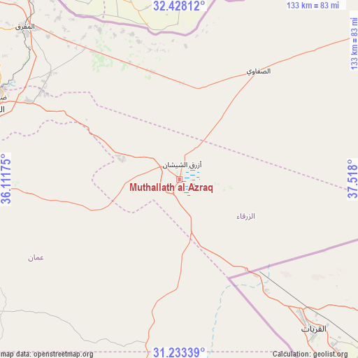
Muthallath al Azraq GPS coordinates[2]
31° 49' 57.684" North, 36° 48' 53.532" East
| Map corner | latitude | longitude |
|---|---|---|
| Upper-left | 32.42812°, | 36.11175° |
| Center: | 31.83269°, | 36.81487° |
| Lower-right: | 31.23339°, | 37.518° |
| Map W x H: | 132.8×132.8 km | = 82.5×82.5mi |
| max Lat: | 33.31405° ⇑68.1% North |
| Muthallath al Azraq: | 31.83269° |
| min Lat: | ⇓31.9% South 29.40842° |
| min Long | Muthallath al A | max Long |
| 34.97918° | 36.81487° | 38.70342° |
| W 97.1%⇐ | ⇒2.9% E |
Elevation
Elevation of Muthallath al Azraq is 516 m = 1693 ft, and this is 169.7 m = 557 ft below average elevation for this country.
| Max E: |
1440 m = 4724 ft | 79% |
| Avg. | 685.7 m = 2250 ft | |
| Muthallath al Azraq | 516 m = 1693 ft | |
Min E: |
-366 m = -1201 ft | 21% |
See also: Jordan elevation on elevation.city.
Geographical zone
Muthallath al Azraq is located in North temperate zone (between Tropic of Cancer and the Arctic Circle). Distance of this Northern Tropic circle is 933.5 km =580 mi to South.| Distance of | km | miles | from Muthallath al Azraq |
|---|---|---|---|
| North Pole | 6467.6 | 4018.8 | to North |
| Arctic Circle | 3861.7 | 2399.5 | to North |
| Tropic Cancer | 933.5 | 580 | to South |
| Equator | 3539.5 | 2199.3 | to South |


Nearby cities:
15 places around Muthallath al Azraq: (largest is in red/bold)
• Al Azraq ash Shamālī
5.7 km =3.5 mi,  14°
14°
• Al Hāshimīyah
73.2 km =45.5 mi,  296°
296°
• Al Khālidīyah
61.7 km =38.3 mi,  308°
308°
• Al Muwaqqar
66.7 km =41.4 mi,  268°
268°
• Az̧ Z̧ulayl
59.8 km =37.2 mi, 302°
• Dayr al Kahf
49.3 km =30.6 mi,  2°
2°
• Muthallath Şabḩā
57.7 km =35.9 mi,  325°
325°
• Qaşr al Ḩallābāt
54.1 km =33.6 mi, 302°
• Rujm ash Shāmī al Gharbī
76.5 km =47.5 mi, 270°
• Russeifa
75.4 km =46.9 mi,  285°
285°
• Saḩāb
76.6 km =47.6 mi, 273°
• Umm al Jimāl
69.4 km =43.1 mi,  322°
322°
• Umm al Qiţţayn
56.4 km =35 mi,  341°
341°
• Zarqa
73.6 km =45.7 mi, 291°
• Şabḩā
62.4 km =38.8 mi, 331°
Sources, notices
• [Note1] Compared only with cities in Jordan existing in our database
• [Src1] Map data: © OpenStreetMap contributors (CC-BY-SA)
• [Src2] Other city data from geonames.org with taken over terms of usage.
• [Src3] Geographical zone / Annual Mean Temperature by Robert A. Rohde @ Wikipedia
