Saḩāb geodata
Saḩāb (Amman) is a seat of a second-order administrative division; located in Jordan in Asia/Amman (GMT+3) time zone. With population of 40,241 people, there are 14 cities with bigger population in this country. Compared to other cities in Jordan, 65.9% of cities are located further ↑North; 79% of cities are located further ←West and 72.5% of cities have lower elevation than Saḩāb. Note1


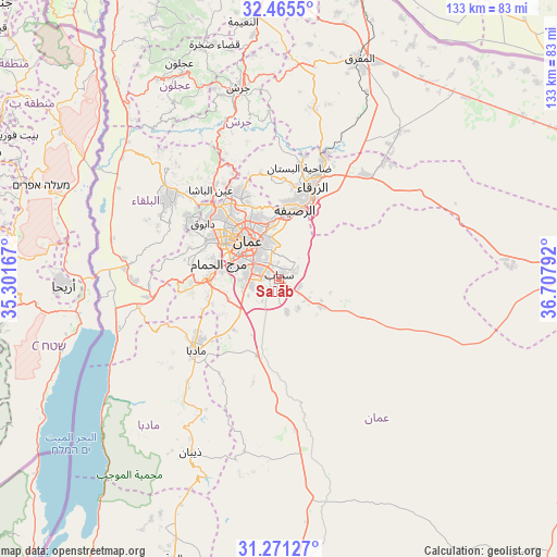
Saḩāb GPS coordinates[2]
31° 52' 13.152" North, 36° 0' 17.244" East
| Map corner | latitude | longitude |
|---|---|---|
| Upper-left | 32.4655°, | 35.30167° |
| Center: | 31.87032°, | 36.00479° |
| Lower-right: | 31.27127°, | 36.70792° |
| Map W x H: | 132.8×132.8 km | = 82.5×82.5mi |
| max Lat: | 33.31405° ⇑65.9% North |
| Saḩāb: | 31.87032° |
| min Lat: | ⇓34.1% South 29.40842° |
| min Long | Saḩāb | max Long |
| 34.97918° | 36.00479° | 38.70342° |
| W 79%⇐ | ⇒21% E |
Elevation
Elevation of Saḩāb is 872 m = 2861 ft, and this is 186.3 m = 611 ft above average elevation for this country.
| Max E: |
1440 m = 4724 ft | 27.5% |
| Saḩāb | 872 m 2861 ft | |
| Avg. | 685.7 m = 2250 ft | |
Min E: |
-366 m = -1201 ft | 72.5% |
See also: Saḩāb elevation on elevation.city.
Geographical zone
Saḩāb is located in North temperate zone (between Tropic of Cancer and the Arctic Circle). Distance of this Northern Tropic circle is 937.7 km =582.7 mi to South.| Distance of | km | miles | from Saḩāb |
|---|---|---|---|
| North Pole | 6463.4 | 4016.2 | to North |
| Arctic Circle | 3857.5 | 2396.9 | to North |
| Tropic Cancer | 937.7 | 582.7 | to South |
| Equator | 3543.6 | 2201.9 | to South |


Nearby cities:
15 places around Saḩāb: (largest is in red/bold)
• Al Jubayhah
18.6 km =11.6 mi,  327°
327°
• Al Juwayyidah
7.2 km =4.5 mi,  285°
285°
• Al Jīzah
19.6 km =12.2 mi,  193°
193°
• Al Muwaqqar
11.6 km =7.2 mi,  122°
122°
• Al ‘Abdallī
13.9 km =8.6 mi,  319°
319°
• Amman
11 km =6.8 mi, 329°
• Ar Ruşayfah
16.6 km =10.3 mi,  9°
9°
• Jāwā
6.5 km =4 mi,  252°
252°
• Nā‘ūr
17 km =10.6 mi,  271°
271°
• Rujm ash Shāmī al Gharbī
3.7 km =2.3 mi,  179°
179°
• Russeifa
16.9 km =10.5 mi, 13°
• Umm al Basātīn
13 km =8.1 mi, 246°
• Umm as Summāq
14.3 km =8.9 mi,  276°
276°
• Ḩayy al Bunayyāt
11.7 km =7.3 mi, 284°
• Ḩayy al Quwaysimah
6.8 km =4.2 mi,  310°
310°
Sources, notices
• [Note1] Compared only with cities in Jordan existing in our database
• [Src1] Map data: © OpenStreetMap contributors (CC-BY-SA)
• [Src2] Other city data from geonames.org with taken over terms of usage.
• [Src3] Geographical zone / Annual Mean Temperature by Robert A. Rohde @ Wikipedia
