Buşayrā geodata
Buşayrā (Tafielah) is a seat of a second-order administrative division; located in Jordan in Asia/Amman (GMT+3) time zone. With population of 7,154 people, there are 45 cities with bigger population in this country. Compared to other cities in Jordan, 89.9% of cities are located further ↑North; 86.2% of cities are located further →East and 94.2% of cities have lower elevation than Buşayrā. Note1


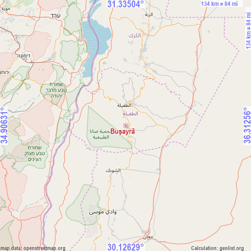
Buşayrā GPS coordinates[2]
30° 43' 57.216" North, 35° 36' 33.948" East
| Map corner | latitude | longitude |
|---|---|---|
| Upper-left | 31.33504°, | 34.90631° |
| Center: | 30.73256°, | 35.60943° |
| Lower-right: | 30.12629°, | 36.31256° |
| Map W x H: | 134.4×134.4 km | = 83.5×83.5mi |
| max Lat: | 33.31405° ⇑89.9% North |
| Buşayrā: | 30.73256° |
| min Lat: | ⇓10.1% South 29.40842° |
| min Long | Buşayrā | max Long |
| 34.97918° | 35.60943° | 38.70342° |
| W 13.8%⇐ | ⇒86.2% E |
Elevation
Elevation of Buşayrā is 1124 m = 3688 ft, and this is 438.3 m = 1438 ft above average elevation for this country.
| Max E: |
1440 m = 4724 ft | 5.8% |
| Buşayrā | 1124 m 3688 ft | |
| Avg. | 685.7 m = 2250 ft | |
Min E: |
-366 m = -1201 ft | 94.2% |
See also: Jordan elevation on elevation.city.
Geographical zone
Buşayrā is located in North temperate zone (between Tropic of Cancer and the Arctic Circle). Distance of this Northern Tropic circle is 811.2 km =504.1 mi to South.| Distance of | km | miles | from Buşayrā |
|---|---|---|---|
| North Pole | 6589.9 | 4094.8 | to North |
| Arctic Circle | 3984 | 2475.5 | to North |
| Tropic Cancer | 811.2 | 504.1 | to South |
| Equator | 3417.1 | 2123.3 | to South |


Nearby cities:
15 places around Buşayrā: (largest is in red/bold)
• Adhruḩ
44.7 km =27.8 mi,  181°
181°
• Adir
54.2 km =33.7 mi,  15°
15°
• Al Khinzīrah
35.4 km =22 mi,  359°
359°
• Al Mazār al Janūbī
38.1 km =23.7 mi,  12°
12°
• Al Ḩasā
36.3 km =22.6 mi,  74°
74°
• Al Ḩusaynīyah
23.5 km =14.6 mi,  130°
130°
• Al Ḩusaynīyah
34.4 km =21.4 mi, 18°
• Ash Shawbak
23.8 km =14.8 mi,  188°
188°
• Aţ Ţafīlah
11.7 km =7.3 mi, 357°
• Karak City
50.1 km =31.1 mi, 16°
• Petra
47.4 km =29.5 mi,  195°
195°
• Qīr Moāv
50.8 km =31.6 mi, 9°
• Safi
36.4 km =22.6 mi,  337°
337°
• ‘Ayy
44.7 km =27.8 mi,  4°
4°
• ‘Izrā
48.1 km =29.9 mi, 9°
Sources, notices
• [Note1] Compared only with cities in Jordan existing in our database
• [Src1] Map data: © OpenStreetMap contributors (CC-BY-SA)
• [Src2] Other city data from geonames.org with taken over terms of usage.
• [Src3] Geographical zone / Annual Mean Temperature by Robert A. Rohde @ Wikipedia
