Sumoto geodata
Sumoto (Hyōgo) is a seat of a second-order administrative division; located in Japan in Asia/Tokyo (GMT+9) time zone. With population of 39,546 people, there are 456 cities with bigger population in this country. Compared to other cities in Japan, 75.1% of cities are located further ↑North; 71.2% of cities are located further →East and 99.8% of cities have higher elevation than Sumoto. Note1


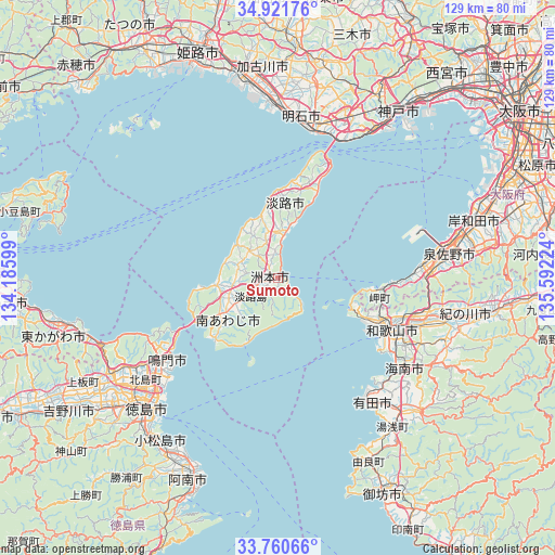
Sumoto GPS coordinates[2]
34° 20' 35.592" North, 134° 53' 20.796" East
| Map corner | latitude | longitude |
|---|---|---|
| Upper-left | 34.92176°, | 134.18599° |
| Center: | 34.34322°, | 134.88911° |
| Lower-right: | 33.76066°, | 135.59224° |
| Map W x H: | 129.1×129.1 km | = 80.2×80.2mi |
| max Lat: | 45.40944° ⇑75.1% North |
| Sumoto: | 34.34322° |
| min Lat: | ⇓24.9% South 24.34478° |
| min Long | Sumoto | max Long |
| 123° | 134.88911° | 145.575° |
| W 28.8%⇐ | ⇒71.2% E |
Elevation
Elevation of Sumoto is -1 m = -3 ft, and this is 85.6 m = 281 ft below average elevation for this country.
| Max E: |
1086 m = 3563 ft | 99.8% |
| Avg. | 84.6 m = 278 ft | |
| Sumoto | -1 m = -3 ft | |
Min E: |
-2 m = -7 ft | 0.2% |
See also: Japan elevation on elevation.city.
Geographical zone
Sumoto is located in North temperate zone (between Tropic of Cancer and the Arctic Circle). Distance of this Northern Tropic circle is 1212.7 km =753.5 mi to South.| Distance of | km | miles | from Sumoto |
|---|---|---|---|
| North Pole | 6188.5 | 3845.4 | to North |
| Arctic Circle | 3582.6 | 2226.1 | to North |
| Tropic Cancer | 1212.7 | 753.5 | to South |
| Equator | 3818.6 | 2372.8 | to South |


Nearby cities:
15 places around Sumoto: (largest is in red/bold)
• Akashi
36.3 km =22.6 mi,  17°
17°
• Arida
36 km =22.4 mi,  144°
144°
• Awaji
15.4 km =9.6 mi,  14°
14°
• Fukura
18.6 km =11.6 mi,  239°
239°
• Hannan
33.2 km =20.6 mi,  91°
91°
• Iwade
40.6 km =25.2 mi,  104°
104°
• Izumisano
39.7 km =24.7 mi,  84°
84°
• Izumisano
40.1 km =24.9 mi, 78°
• Kainan
36.7 km =22.8 mi,  125°
125°
• Minamiawaji
13 km =8.1 mi,  233°
233°
• Minato
27.9 km =17.3 mi,  120°
120°
• Narutochō-mitsuishi
30.3 km =18.8 mi, 238°
• Sennan
34.8 km =21.6 mi, 89°
• Tajiri
34 km =21.1 mi,  74°
74°
• Wakayama
28.3 km =17.6 mi, 115°
Sources, notices
• [Note1] Compared only with cities in Japan existing in our database
• [Src1] Map data: © OpenStreetMap contributors (CC-BY-SA)
• [Src2] Other city data from geonames.org with taken over terms of usage.
• [Src3] Geographical zone / Annual Mean Temperature by Robert A. Rohde @ Wikipedia
