Narutochō-mitsuishi geodata
Narutochō-mitsuishi (Tokushima) is a seat of a second-order administrative division; located in Japan in Asia/Tokyo (GMT+9) time zone. With population of 64,082 people, there are 305 cities with bigger population in this country. Compared to other cities in Japan, 77.8% of cities are located further ↑North; 72.5% of cities are located further →East and 96.8% of cities have higher elevation than Narutochō-mitsuishi. Note1


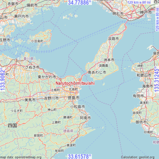
Narutochō-mitsuishi GPS coordinates[2]
34° 11' 57.588" North, 134° 36' 33.552" East
| Map corner | latitude | longitude |
|---|---|---|
| Upper-left | 34.77886°, | 133.9062° |
| Center: | 34.19933°, | 134.60932° |
| Lower-right: | 33.61578°, | 135.31245° |
| Map W x H: | 129.3×129.3 km | = 80.3×80.3mi |
| max Lat: | 45.40944° ⇑77.8% North |
| Narutochō-mitsuishi: | 34.19933° |
| min Lat: | ⇓22.2% South 24.34478° |
| min Long | Narutochō-mits | max Long |
| 123° | 134.60932° | 145.575° |
| W 27.5%⇐ | ⇒72.5% E |
Elevation
Elevation of Narutochō-mitsuishi is 2 m = 7 ft, and this is 82.6 m = 271 ft below average elevation for this country.
| Max E: |
1086 m = 3563 ft | 96.8% |
| Avg. | 84.6 m = 278 ft | |
| Narutochō-mitsuishi | 2 m = 7 ft | |
Min E: |
-2 m = -7 ft | 3.2% |
See also: Narutochō-mitsuishi elevation on elevation.city.
Geographical zone
Narutochō-mitsuishi is located in North temperate zone (between Tropic of Cancer and the Arctic Circle). Distance of this Northern Tropic circle is 1196.7 km =743.6 mi to South.| Distance of | km | miles | from Narutochō-mitsuishi |
|---|---|---|---|
| North Pole | 6204.5 | 3855.3 | to North |
| Arctic Circle | 3598.6 | 2236.1 | to North |
| Tropic Cancer | 1196.7 | 743.6 | to South |
| Equator | 3802.6 | 2362.8 | to South |


Nearby cities:
15 places around Narutochō-mitsuishi: (largest is in red/bold)
• Anan
31.7 km =19.7 mi,  173°
173°
• Awa
32.2 km =20 mi,  248°
248°
• Awaji
42.8 km =26.6 mi,  43°
43°
• Fukura
11.7 km =7.3 mi,  56°
56°
• Higashikagawa
25.1 km =15.6 mi,  272°
272°
• Ishii
21.3 km =13.2 mi,  226°
226°
• Kamojimachō-jōgejima
28 km =17.4 mi,  238°
238°
• Komatsushimachō
22.3 km =13.9 mi,  186°
186°
• Minamiawaji
17.4 km =10.8 mi, 61°
• Sanuki
35.7 km =22.2 mi,  282°
282°
• Shido
42.4 km =26.3 mi,  288°
288°
• Sumoto
30.3 km =18.8 mi, 58°
• Tokushima
15.3 km =9.5 mi, 194°
• Wakimachi
44.8 km =27.8 mi, 250°
• Yoshinogawa
34.2 km =21.3 mi, 238°
Sources, notices
• [Note1] Compared only with cities in Japan existing in our database
• [Src1] Map data: © OpenStreetMap contributors (CC-BY-SA)
• [Src2] Other city data from geonames.org with taken over terms of usage.
• [Src3] Geographical zone / Annual Mean Temperature by Robert A. Rohde @ Wikipedia
