Fukura geodata
Fukura (Hyōgo) is a populated place; located in Japan in Asia/Tokyo (GMT+9) time zone. With population of 18,721 people, there are 713 cities with bigger population in this country. Compared to other cities in Japan, 76.6% of cities are located further ↑North; 72.2% of cities are located further →East and 86% of cities have higher elevation than Fukura. Note1


Fukura GPS coordinates[2]
34° 15' 27.54" North, 134° 42' 55.26" East
| Map corner | latitude | longitude |
|---|---|---|
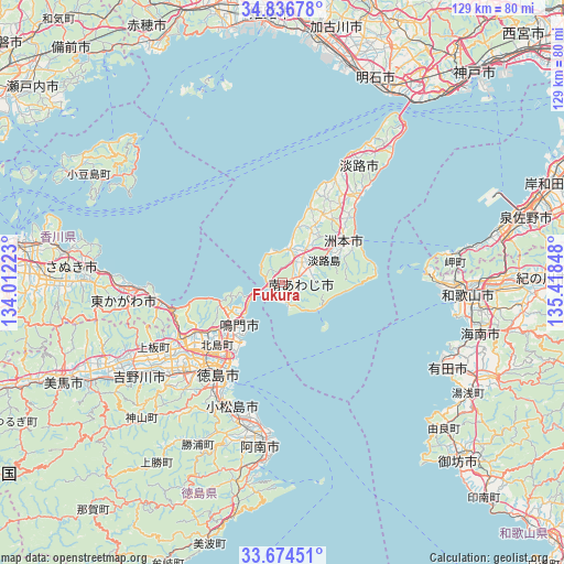
| Upper-left | 34.83678°, | 134.01223° |
| Center: | 34.25765°, | 134.71535° |
| Lower-right: | 33.67451°, | 135.41848° |
| Map W x H: | 129.2×129.2 km | = 80.3×80.3mi |
| max Lat: | 45.40944° ⇑76.6% North |
| Fukura: | 34.25765° |
| min Lat: | ⇓23.4% South 24.34478° |
| min Long | Fukura | max Long |
| 123° | 134.71535° | 145.575° |
| W 27.8%⇐ | ⇒72.2% E |
Elevation
Elevation of Fukura is 6 m = 20 ft, and this is 78.6 m = 258 ft below average elevation for this country.
| Max E: |
1086 m = 3563 ft | 86% |
| Avg. | 84.6 m = 278 ft | |
| Fukura | 6 m = 20 ft | |
Min E: |
-2 m = -7 ft | 14% |
See also: Japan elevation on elevation.city.
Geographical zone
Fukura is located in North temperate zone (between Tropic of Cancer and the Arctic Circle). Distance of this Northern Tropic circle is 1203.2 km =747.6 mi to South.| Distance of | km | miles | from Fukura |
|---|---|---|---|
| North Pole | 6198 | 3851.3 | to North |
| Arctic Circle | 3592.1 | 2232 | to North |
| Tropic Cancer | 1203.2 | 747.6 | to South |
| Equator | 3809.1 | 2366.9 | to South |


Nearby cities:
15 places around Fukura: (largest is in red/bold)
• Anan
38.4 km =23.9 mi,  189°
189°
• Arida
42 km =26.1 mi,  117°
117°
• Awa
43.7 km =27.2 mi,  245°
245°
• Awaji
31.4 km =19.5 mi,  38°
38°
• Higashikagawa
35.2 km =21.9 mi,  261°
261°
• Ishii
32.8 km =20.4 mi,  229°
229°
• Kamojimachō-jōgejima
39.7 km =24.7 mi,  237°
237°
• Komatsushimachō
31.1 km =19.3 mi,  202°
202°
• Minamiawaji
5.8 km =3.6 mi,  71°
71°
• Minato
40.2 km =25 mi,  96°
96°
• Narutochō-mitsuishi
11.7 km =7.3 mi, 236°
• Sanuki
44.7 km =27.8 mi,  271°
271°
• Sumoto
18.6 km =11.6 mi,  59°
59°
• Tokushima
25.3 km =15.7 mi,  212°
212°
• Wakayama
41.6 km =25.8 mi,  93°
93°
Sources, notices
• [Note1] Compared only with cities in Japan existing in our database
• [Src1] Map data: © OpenStreetMap contributors (CC-BY-SA)
• [Src2] Other city data from geonames.org with taken over terms of usage.
• [Src3] Geographical zone / Annual Mean Temperature by Robert A. Rohde @ Wikipedia
