Izumo geodata
Izumo (Shimane) is a seat of a second-order administrative division; located in Japan in Asia/Tokyo (GMT+9) time zone. With population of 89,286 people, there are 224 cities with bigger population in this country. Compared to other cities in Japan, 50.2% of cities are located further ↑North; 80.3% of cities are located further →East and 86% of cities have higher elevation than Izumo. Note1


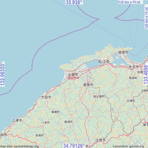
Izumo GPS coordinates[2]
35° 22' 0.012" North, 132° 46' 0.012" East
| Map corner | latitude | longitude |
|---|---|---|
| Upper-left | 35.938°, | 132.06355° |
| Center: | 35.36667°, | 132.76667° |
| Lower-right: | 34.79126°, | 133.4698° |
| Map W x H: | 127.5×127.5 km | = 79.2×79.2mi |
| max Lat: | 45.40944° ⇑50.2% North |
| Izumo: | 35.36667° |
| min Lat: | ⇓49.8% South 24.34478° |
| min Long | Izumo | max Long |
| 123° | 132.76667° | 145.575° |
| W 19.7%⇐ | ⇒80.3% E |
Elevation
Elevation of Izumo is 6 m = 20 ft, and this is 78.6 m = 258 ft below average elevation for this country.
| Max E: |
1086 m = 3563 ft | 86% |
| Avg. | 84.6 m = 278 ft | |
| Izumo | 6 m = 20 ft | |
Min E: |
-2 m = -7 ft | 14% |
See also: Izumo elevation on elevation.city.
Geographical zone
Izumo is located in North temperate zone (between Tropic of Cancer and the Arctic Circle). Distance of this Northern Tropic circle is 1326.5 km =824.2 mi to South.| Distance of | km | miles | from Izumo |
|---|---|---|---|
| North Pole | 6074.7 | 3774.6 | to North |
| Arctic Circle | 3468.8 | 2155.4 | to North |
| Tropic Cancer | 1326.5 | 824.2 | to South |
| Equator | 3932.4 | 2443.5 | to South |


Nearby cities:
15 places around Izumo: (largest is in red/bold)
• Aki-takata
77.4 km =48.1 mi,  185°
185°
• Gōtsuchō
63.3 km =39.3 mi,  230°
230°
• Hamada
82.2 km =51.1 mi, 229°
• Hiratachō
8.7 km =5.4 mi,  31°
31°
• Matsue
28.8 km =17.9 mi,  63°
63°
• Miyoshi
63.5 km =39.5 mi,  173°
173°
• Niimi
76.6 km =47.6 mi,  123°
123°
• Oda
30.4 km =18.9 mi, 232°
• Sakaiminato
46.2 km =28.7 mi,  65°
65°
• Shōbara
61.8 km =38.4 mi,  158°
158°
• Unnan
18.3 km =11.4 mi,  138°
138°
• Yasugi
38 km =23.6 mi,  95°
95°
• Yasugichō
43.5 km =27 mi,  81°
81°
• Yonago
51.9 km =32.2 mi, 81°
• Ōdachō-ōda
30.6 km =19 mi, 230°
Sources, notices
• [Note1] Compared only with cities in Japan existing in our database
• [Src1] Map data: © OpenStreetMap contributors (CC-BY-SA)
• [Src2] Other city data from geonames.org with taken over terms of usage.
• [Src3] Geographical zone / Annual Mean Temperature by Robert A. Rohde @ Wikipedia
