Hamamatsu geodata
Hamamatsu (Shizuoka) is a seat of a second-order administrative division; located in Japan in Asia/Tokyo (GMT+9) time zone. With population of 605,098 people, there are 19 cities with bigger population in this country. Compared to other cities in Japan, 68.3% of cities are located further ↑North; 52% of cities are located further ←West and 95.3% of cities have higher elevation than Hamamatsu. Note1


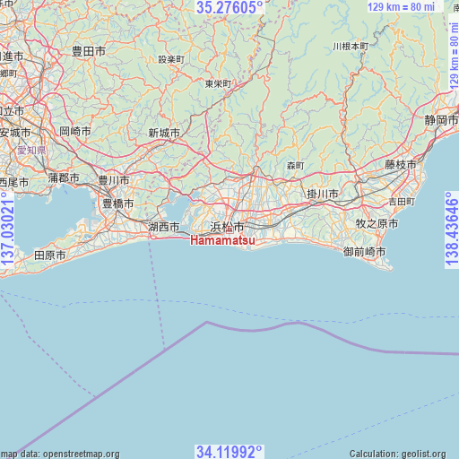
Hamamatsu GPS coordinates[2]
34° 42' 0" North, 137° 43' 59.988" East
| Map corner | latitude | longitude |
|---|---|---|
| Upper-left | 35.27605°, | 137.03021° |
| Center: | 34.7°, | 137.73333° |
| Lower-right: | 34.11992°, | 138.43646° |
| Map W x H: | 128.5×128.5 km | = 79.8×79.8mi |
| max Lat: | 45.40944° ⇑68.3% North |
| Hamamatsu: | 34.7° |
| min Lat: | ⇓31.7% South 24.34478° |
| min Long | Hamamatsu | max Long |
| 123° | 137.73333° | 145.575° |
| W 52%⇐ | ⇒48% E |
Elevation
Elevation of Hamamatsu is 3 m = 10 ft, and this is 81.6 m = 268 ft below average elevation for this country.
| Max E: |
1086 m = 3563 ft | 95.3% |
| Avg. | 84.6 m = 278 ft | |
| Hamamatsu | 3 m = 10 ft | |
Min E: |
-2 m = -7 ft | 4.7% |
See also: Hamamatsu elevation on elevation.city.
Geographical zone
Hamamatsu is located in North temperate zone (between Tropic of Cancer and the Arctic Circle). Distance of this Northern Tropic circle is 1252.4 km =778.2 mi to South.| Distance of | km | miles | from Hamamatsu |
|---|---|---|---|
| North Pole | 6148.8 | 3820.7 | to North |
| Arctic Circle | 3542.9 | 2201.5 | to North |
| Tropic Cancer | 1252.4 | 778.2 | to South |
| Equator | 3858.3 | 2397.4 | to South |


Nearby cities:
15 places around Hamamatsu: (largest is in red/bold)
• Fukuroi
17.7 km =11 mi,  71°
71°
• Hamakita
12 km =7.5 mi,  22°
22°
• Handayama
8.3 km =5.2 mi,  2°
2°
• Iwata
10.7 km =6.6 mi,  90°
90°
• Kakegawa
26.9 km =16.7 mi, 74°
• Kanaya
38.4 km =23.9 mi, 69°
• Kikugawa
35.3 km =21.9 mi, 89°
• Kosai
19.3 km =12 mi,  270°
270°
• Kozakai-chō
36 km =22.4 mi,  288°
288°
• Makinohara
38.8 km =24.1 mi,  77°
77°
• Mori
23.5 km =14.6 mi,  50°
50°
• Shinshiro
30.8 km =19.1 mi,  316°
316°
• Tahara
42.8 km =26.6 mi, 265°
• Toyohashi
32.8 km =20.4 mi,  283°
283°
• Toyokawa
33.1 km =20.6 mi, 293°
Sources, notices
• [Note1] Compared only with cities in Japan existing in our database
• [Src1] Map data: © OpenStreetMap contributors (CC-BY-SA)
• [Src2] Other city data from geonames.org with taken over terms of usage.
• [Src3] Geographical zone / Annual Mean Temperature by Robert A. Rohde @ Wikipedia
