Shinshiro geodata
Shinshiro (Aichi) is a seat of a second-order administrative division; located in Japan in Asia/Tokyo (GMT+9) time zone. With population of 36,069 people, there are 491 cities with bigger population in this country. Compared to other cities in Japan, 61% of cities are located further ↑North; 51.7% of cities are located further ←West and 61.3% of cities have lower elevation than Shinshiro. Note1


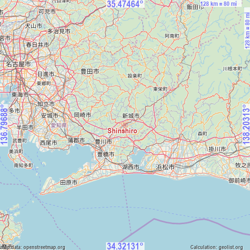
Shinshiro GPS coordinates[2]
34° 54' 0" North, 137° 30' 0" East
| Map corner | latitude | longitude |
|---|---|---|
| Upper-left | 35.47464°, | 136.79688° |
| Center: | 34.9°, | 137.5° |
| Lower-right: | 34.32131°, | 138.20313° |
| Map W x H: | 128.2×128.2 km | = 79.7×79.7mi |
| max Lat: | 45.40944° ⇑61% North |
| Shinshiro: | 34.9° |
| min Lat: | ⇓39% South 24.34478° |
| min Long | Shinshiro | max Long |
| 123° | 137.5° | 145.575° |
| W 51.7%⇐ | ⇒48.3% E |
Elevation
Elevation of Shinshiro is 48 m = 157 ft, and this is 36.6 m = 120 ft below average elevation for this country.
| Max E: |
1086 m = 3563 ft | 38.7% |
| Avg. | 84.6 m = 278 ft | |
| Shinshiro | 48 m = 157 ft | |
Min E: |
-2 m = -7 ft | 61.3% |
See also: Japan elevation on elevation.city.
Geographical zone
Shinshiro is located in North temperate zone (between Tropic of Cancer and the Arctic Circle). Distance of this Northern Tropic circle is 1274.6 km =792 mi to South.| Distance of | km | miles | from Shinshiro |
|---|---|---|---|
| North Pole | 6126.5 | 3806.8 | to North |
| Arctic Circle | 3520.7 | 2187.7 | to North |
| Tropic Cancer | 1274.6 | 792 | to South |
| Equator | 3880.5 | 2411.2 | to South |


Nearby cities:
15 places around Shinshiro: (largest is in red/bold)
• Anjō
38.8 km =24.1 mi,  279°
279°
• Gamagōri
25.4 km =15.8 mi,  253°
253°
• Hamakita
28.1 km =17.5 mi,  113°
113°
• Hamamatsu
30.8 km =19.1 mi,  136°
136°
• Handayama
25.8 km =16 mi,  122°
122°
• Iwata
38.9 km =24.2 mi, 124°
• Kosai
22.3 km =13.9 mi,  174°
174°
• Kozakai-chō
17 km =10.6 mi,  229°
229°
• Mori
40.2 km =25 mi,  100°
100°
• Nishio
41.2 km =25.6 mi,  264°
264°
• Okazaki
30.9 km =19.2 mi, 280°
• Tahara
33.6 km =20.9 mi,  219°
219°
• Toyohashi
18.3 km =11.4 mi, 215°
• Toyokawa
13 km =8.1 mi, 224°
• Toyota
37.8 km =23.5 mi,  302°
302°
Sources, notices
• [Note1] Compared only with cities in Japan existing in our database
• [Src1] Map data: © OpenStreetMap contributors (CC-BY-SA)
• [Src2] Other city data from geonames.org with taken over terms of usage.
• [Src3] Geographical zone / Annual Mean Temperature by Robert A. Rohde @ Wikipedia
