Ōmihachiman geodata
Ōmihachiman (Shiga) is a seat of a second-order administrative division; located in Japan in Asia/Tokyo (GMT+9) time zone. With population of 69,189 people, there are 279 cities with bigger population in this country. Compared to other cities in Japan, 55.6% of cities are located further ↑North; 61% of cities are located further →East and 73.9% of cities have lower elevation than Ōmihachiman. Note1


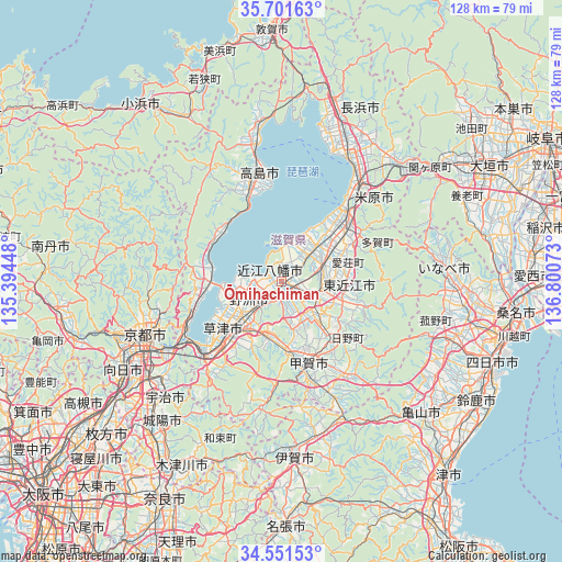
Ōmihachiman GPS coordinates[2]
35° 7' 42.996" North, 136° 5' 51.36" East
| Map corner | latitude | longitude |
|---|---|---|
| Upper-left | 35.70163°, | 135.39448° |
| Center: | 35.12861°, | 136.0976° |
| Lower-right: | 34.55153°, | 136.80073° |
| Map W x H: | 127.9×127.9 km | = 79.5×79.5mi |
| max Lat: | 45.40944° ⇑55.6% North |
| Ōmihachiman: | 35.12861° |
| min Lat: | ⇓44.4% South 24.34478° |
| min Long | Ōmihachiman | max Long |
| 123° | 136.0976° | 145.575° |
| W 39%⇐ | ⇒61% E |
Elevation
Elevation of Ōmihachiman is 91 m = 299 ft, and this is 6.4 m = 21 ft above average elevation for this country.
| Max E: |
1086 m = 3563 ft | 26.1% |
| Ōmihachiman | 91 m 299 ft | |
| Avg. | 84.6 m = 278 ft | |
Min E: |
-2 m = -7 ft | 73.9% |
See also: Ōmihachiman elevation on elevation.city.
Geographical zone
Ōmihachiman is located in North temperate zone (between Tropic of Cancer and the Arctic Circle). Distance of this Northern Tropic circle is 1300 km =807.8 mi to South.| Distance of | km | miles | from Ōmihachiman |
|---|---|---|---|
| North Pole | 6101.1 | 3791 | to North |
| Arctic Circle | 3495.2 | 2171.8 | to North |
| Tropic Cancer | 1300 | 807.8 | to South |
| Equator | 3905.9 | 2427 | to South |


Nearby cities:
15 places around Ōmihachiman: (largest is in red/bold)
• Higashiōmi
15.3 km =9.5 mi,  100°
100°
• Hikone
19.3 km =12 mi,  45°
45°
• Hino
19.9 km =12.4 mi,  135°
135°
• Kitahama
17 km =10.6 mi,  284°
284°
• Konan
14.4 km =8.9 mi,  180°
180°
• Kusatsu
17.2 km =10.7 mi,  223°
223°
• Kōka
17.4 km =10.8 mi,  161°
161°
• Maibara
26.9 km =16.7 mi,  38°
38°
• Minakuchichō-matoba
19.1 km =11.9 mi, 160°
• Moriyama
12.5 km =7.8 mi,  236°
236°
• Nagahama
32.2 km =20 mi,  28°
28°
• Rittō
14.3 km =8.9 mi, 218°
• Yasu
7.9 km =4.9 mi,  246°
246°
• Youkaichi
9.2 km =5.7 mi, 98°
• Ōtsu
25.4 km =15.8 mi, 235°
Sources, notices
• [Note1] Compared only with cities in Japan existing in our database
• [Src1] Map data: © OpenStreetMap contributors (CC-BY-SA)
• [Src2] Other city data from geonames.org with taken over terms of usage.
• [Src3] Geographical zone / Annual Mean Temperature by Robert A. Rohde @ Wikipedia
