Kusatsu geodata
Kusatsu (Shiga) is a seat of a second-order administrative division; located in Japan in Asia/Tokyo (GMT+9) time zone. With population of 127,680 people, there are 166 cities with bigger population in this country. Compared to other cities in Japan, 58.1% of cities are located further ↑North; 61.8% of cities are located further →East and 76.2% of cities have lower elevation than Kusatsu. Note1


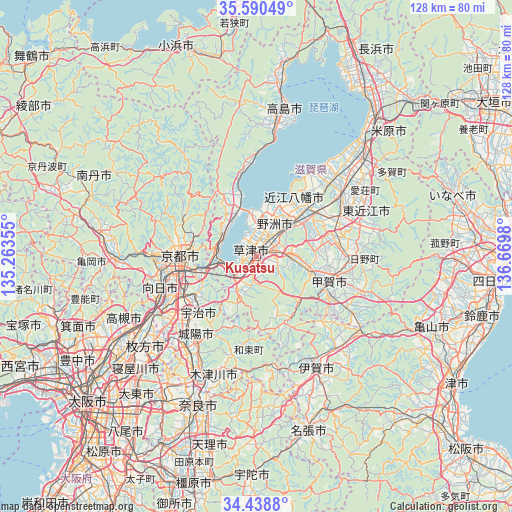
Kusatsu GPS coordinates[2]
35° 1' 0.012" North, 135° 58' 0.012" East
| Map corner | latitude | longitude |
|---|---|---|
| Upper-left | 35.59049°, | 135.26355° |
| Center: | 35.01667°, | 135.96667° |
| Lower-right: | 34.4388°, | 136.6698° |
| Map W x H: | 128.1×128.1 km | = 79.6×79.6mi |
| max Lat: | 45.40944° ⇑58.1% North |
| Kusatsu: | 35.01667° |
| min Lat: | ⇓41.9% South 24.34478° |
| min Long | Kusatsu | max Long |
| 123° | 135.96667° | 145.575° |
| W 38.2%⇐ | ⇒61.8% E |
Elevation
Elevation of Kusatsu is 102 m = 335 ft, and this is 17.4 m = 57 ft above average elevation for this country.
| Max E: |
1086 m = 3563 ft | 23.8% |
| Kusatsu | 102 m 335 ft | |
| Avg. | 84.6 m = 278 ft | |
Min E: |
-2 m = -7 ft | 76.2% |
See also: Kusatsu elevation on elevation.city.
Geographical zone
Kusatsu is located in North temperate zone (between Tropic of Cancer and the Arctic Circle). Distance of this Northern Tropic circle is 1287.6 km =800.1 mi to South.| Distance of | km | miles | from Kusatsu |
|---|---|---|---|
| North Pole | 6113.6 | 3798.8 | to North |
| Arctic Circle | 3507.7 | 2179.6 | to North |
| Tropic Cancer | 1287.6 | 800.1 | to South |
| Equator | 3893.5 | 2419.3 | to South |


Nearby cities:
15 places around Kusatsu: (largest is in red/bold)
• Jōyō
24.2 km =15 mi,  217°
217°
• Kamigyō-ku
19.2 km =11.9 mi,  274°
274°
• Kitahama
17.3 km =10.7 mi,  344°
344°
• Konan
12 km =7.5 mi,  99°
99°
• Kyoto
19.4 km =12.1 mi, 271°
• Kōka
17.8 km =11.1 mi, 103°
• Minakuchichō-matoba
19 km =11.8 mi,  106°
106°
• Moriyama
5.8 km =3.6 mi,  15°
15°
• Mukō
24.6 km =15.3 mi,  256°
256°
• Rittō
3.2 km =2 mi,  68°
68°
• Uji
20.5 km =12.7 mi,  226°
226°
• Yasu
10.4 km =6.5 mi,  26°
26°
• Youkaichi
23.8 km =14.8 mi,  62°
62°
• Ōmihachiman
17.2 km =10.7 mi,  43°
43°
• Ōtsu
9.3 km =5.8 mi, 258°
Sources, notices
• [Note1] Compared only with cities in Japan existing in our database
• [Src1] Map data: © OpenStreetMap contributors (CC-BY-SA)
• [Src2] Other city data from geonames.org with taken over terms of usage.
• [Src3] Geographical zone / Annual Mean Temperature by Robert A. Rohde @ Wikipedia
