Anjō geodata
Anjō (Aichi) is a seat of a second-order administrative division; located in Japan in Asia/Tokyo (GMT+9) time zone. With population of 178,402 people, there are 115 cities with bigger population in this country. Compared to other cities in Japan, 60.3% of cities are located further ↑North; 50.7% of cities are located further →East and 59.1% of cities have higher elevation than Anjō. Note1


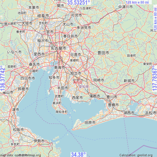
Anjō GPS coordinates[2]
34° 57' 29.808" North, 137° 4' 49.944" East
| Map corner | latitude | longitude |
|---|---|---|
| Upper-left | 35.53251°, | 136.37742° |
| Center: | 34.95828°, | 137.08054° |
| Lower-right: | 34.38°, | 137.78367° |
| Map W x H: | 128.1×128.1 km | = 79.6×79.6mi |
| max Lat: | 45.40944° ⇑60.3% North |
| Anjō: | 34.95828° |
| min Lat: | ⇓39.7% South 24.34478° |
| min Long | Anjō | max Long |
| 123° | 137.08054° | 145.575° |
| W 49.3%⇐ | ⇒50.7% E |
Elevation
Elevation of Anjō is 20 m = 66 ft, and this is 64.6 m = 212 ft below average elevation for this country.
| Max E: |
1086 m = 3563 ft | 59.1% |
| Avg. | 84.6 m = 278 ft | |
| Anjō | 20 m = 66 ft | |
Min E: |
-2 m = -7 ft | 40.9% |
See also: Anjō elevation on elevation.city.
Geographical zone
Anjō is located in North temperate zone (between Tropic of Cancer and the Arctic Circle). Distance of this Northern Tropic circle is 1281.1 km =796 mi to South.| Distance of | km | miles | from Anjō |
|---|---|---|---|
| North Pole | 6120.1 | 3802.9 | to North |
| Arctic Circle | 3514.2 | 2183.6 | to North |
| Tropic Cancer | 1281.1 | 796 | to South |
| Equator | 3887 | 2415.3 | to South |


Nearby cities:
15 places around Anjō: (largest is in red/bold)
• Chiryū
6.3 km =3.9 mi,  317°
317°
• Gamagōri
19.7 km =12.2 mi,  134°
134°
• Handa
15.8 km =9.8 mi,  238°
238°
• Hekinan
12.2 km =7.6 mi,  226°
226°
• Ishiki
18.5 km =11.5 mi,  198°
198°
• Kariya
9.3 km =5.8 mi,  287°
287°
• Miyoshi
14.6 km =9.1 mi,  3°
3°
• Nishio
10.6 km =6.6 mi, 195°
• Okazaki
7.9 km =4.9 mi,  96°
96°
• Takahama
10 km =6.2 mi, 242°
• Taketoyo
19.2 km =11.9 mi, 231°
• Toyoake
11.5 km =7.1 mi, 320°
• Toyota
15.3 km =9.5 mi,  24°
24°
• Tōkai
17.2 km =10.7 mi, 294°
• Ōbu
13.6 km =8.5 mi,  298°
298°
Sources, notices
• [Note1] Compared only with cities in Japan existing in our database
• [Src1] Map data: © OpenStreetMap contributors (CC-BY-SA)
• [Src2] Other city data from geonames.org with taken over terms of usage.
• [Src3] Geographical zone / Annual Mean Temperature by Robert A. Rohde @ Wikipedia
