Okazaki geodata
Okazaki (Aichi) is a seat of a second-order administrative division; located in Japan in Asia/Tokyo (GMT+9) time zone. With population of 352,361 people, there are 50 cities with bigger population in this country. Compared to other cities in Japan, 60.4% of cities are located further ↑North; 50% of cities are located further ←West and 54.6% of cities have lower elevation than Okazaki. Note1


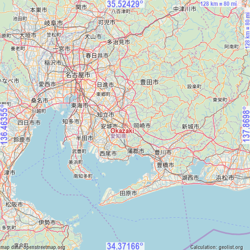
Okazaki GPS coordinates[2]
34° 57' 0" North, 137° 10' 0.012" East
| Map corner | latitude | longitude |
|---|---|---|
| Upper-left | 35.52429°, | 136.46355° |
| Center: | 34.95°, | 137.16667° |
| Lower-right: | 34.37166°, | 137.8698° |
| Map W x H: | 128.2×128.2 km | = 79.7×79.7mi |
| max Lat: | 45.40944° ⇑60.4% North |
| Okazaki: | 34.95° |
| min Lat: | ⇓39.6% South 24.34478° |
| min Long | Okazaki | max Long |
| 123° | 137.16667° | 145.575° |
| W 50%⇐ | ⇒50% E |
Elevation
Elevation of Okazaki is 34 m = 112 ft, and this is 50.6 m = 166 ft below average elevation for this country.
| Max E: |
1086 m = 3563 ft | 45.4% |
| Avg. | 84.6 m = 278 ft | |
| Okazaki | 34 m = 112 ft | |
Min E: |
-2 m = -7 ft | 54.6% |
See also: Okazaki elevation on elevation.city.
Geographical zone
Okazaki is located in North temperate zone (between Tropic of Cancer and the Arctic Circle). Distance of this Northern Tropic circle is 1280.2 km =795.5 mi to South.| Distance of | km | miles | from Okazaki |
|---|---|---|---|
| North Pole | 6121 | 3803.4 | to North |
| Arctic Circle | 3515.1 | 2184.2 | to North |
| Tropic Cancer | 1280.2 | 795.5 | to South |
| Equator | 3886.1 | 2414.7 | to South |


Nearby cities:
15 places around Okazaki: (largest is in red/bold)
• Anjō
7.9 km =4.9 mi,  276°
276°
• Chiryū
13.4 km =8.3 mi,  294°
294°
• Gamagōri
14.3 km =8.9 mi,  154°
154°
• Handa
22.5 km =14 mi,  250°
250°
• Hekinan
18.3 km =11.4 mi, 246°
• Ishiki
21.6 km =13.4 mi,  219°
219°
• Kariya
17.1 km =10.6 mi, 282°
• Kozakai-chō
24.2 km =15 mi,  133°
133°
• Miyoshi
17 km =10.6 mi,  335°
335°
• Nishio
14.1 km =8.8 mi,  228°
228°
• Nisshin
23.2 km =14.4 mi,  333°
333°
• Takahama
17.1 km =10.6 mi,  257°
257°
• Toyoake
18.1 km =11.2 mi,  302°
302°
• Toyota
14.9 km =9.3 mi,  354°
354°
• Ōbu
21.2 km =13.2 mi, 290°
Sources, notices
• [Note1] Compared only with cities in Japan existing in our database
• [Src1] Map data: © OpenStreetMap contributors (CC-BY-SA)
• [Src2] Other city data from geonames.org with taken over terms of usage.
• [Src3] Geographical zone / Annual Mean Temperature by Robert A. Rohde @ Wikipedia
