Amagi geodata
Amagi (Fukuoka) is a populated place; located in Japan in Asia/Tokyo (GMT+9) time zone. With population of 42,312 people, there are 432 cities with bigger population in this country. Compared to other cities in Japan, 86.4% of cities are located further ↑North; 90.4% of cities are located further →East and 56.8% of cities have lower elevation than Amagi. Note1


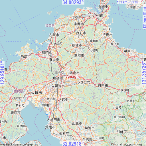
Amagi GPS coordinates[2]
33° 25' 4.944" North, 130° 39' 14.868" East
| Map corner | latitude | longitude |
|---|---|---|
| Upper-left | 34.00293°, | 129.95101° |
| Center: | 33.41804°, | 130.65413° |
| Lower-right: | 32.82918°, | 131.35726° |
| Map W x H: | 130.5×130.5 km | = 81.1×81.1mi |
| max Lat: | 45.40944° ⇑86.4% North |
| Amagi: | 33.41804° |
| min Lat: | ⇓13.6% South 24.34478° |
| min Long | Amagi | max Long |
| 123° | 130.65413° | 145.575° |
| W 9.6%⇐ | ⇒90.4% E |
Elevation
Elevation of Amagi is 38 m = 125 ft, and this is 46.6 m = 153 ft below average elevation for this country.
| Max E: |
1086 m = 3563 ft | 43.2% |
| Avg. | 84.6 m = 278 ft | |
| Amagi | 38 m = 125 ft | |
Min E: |
-2 m = -7 ft | 56.8% |
See also: Amagi elevation on elevation.city.
Geographical zone
Amagi is located in North temperate zone (between Tropic of Cancer and the Arctic Circle). Distance of this Northern Tropic circle is 1109.8 km =689.6 mi to South.| Distance of | km | miles | from Amagi |
|---|---|---|---|
| North Pole | 6291.3 | 3909.2 | to North |
| Arctic Circle | 3685.4 | 2290 | to North |
| Tropic Cancer | 1109.8 | 689.6 | to South |
| Equator | 3715.7 | 2308.8 | to South |


Nearby cities:
15 places around Amagi: (largest is in red/bold)
• Asakura
6 km =3.7 mi,  93°
93°
• Chikushino-shi
15.5 km =9.6 mi,  304°
304°
• Dazaifu
16 km =9.9 mi,  311°
311°
• Iizuka
24.5 km =15.2 mi,  7°
7°
• Kama
15.3 km =9.5 mi,  32°
32°
• Kasuga
21.6 km =13.4 mi, 303°
• Kurume
17 km =10.6 mi,  228°
228°
• Ogōri
10.4 km =6.5 mi,  250°
250°
• Sasaguri
24 km =14.9 mi,  336°
336°
• Tanushimarumachi-toyoki
8 km =5 mi,  160°
160°
• Tosu
14 km =8.7 mi, 245°
• Ukiha
11.2 km =7 mi,  127°
127°
• Umi
21.4 km =13.3 mi,  321°
321°
• Yame
21.1 km =13.1 mi,  181°
181°
• Ōnojō
20.9 km =13 mi, 308°
Sources, notices
• [Note1] Compared only with cities in Japan existing in our database
• [Src1] Map data: © OpenStreetMap contributors (CC-BY-SA)
• [Src2] Other city data from geonames.org with taken over terms of usage.
• [Src3] Geographical zone / Annual Mean Temperature by Robert A. Rohde @ Wikipedia
