Ukiha geodata
Ukiha (Fukuoka) is a seat of a second-order administrative division; located in Japan in Asia/Tokyo (GMT+9) time zone. In our database, there are 767 cities with bigger population. Compared to other cities in Japan, 87.2% of cities are located further ↑North; 88.8% of cities are located further →East and 51.1% of cities have higher elevation than Ukiha. Note1


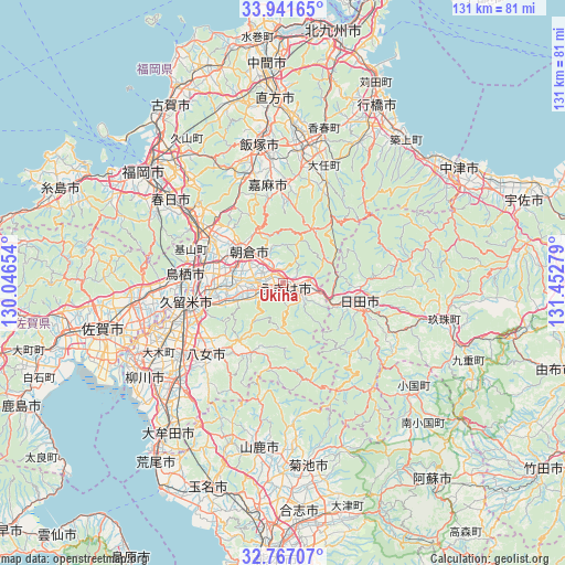
Ukiha GPS coordinates[2]
33° 21' 22.824" North, 130° 44' 58.776" East
| Map corner | latitude | longitude |
|---|---|---|
| Upper-left | 33.94165°, | 130.04654° |
| Center: | 33.35634°, | 130.74966° |
| Lower-right: | 32.76707°, | 131.45279° |
| Map W x H: | 130.6×130.6 km | = 81.2×81.2mi |
| max Lat: | 45.40944° ⇑87.2% North |
| Ukiha: | 33.35634° |
| min Lat: | ⇓12.8% South 24.34478° |
| min Long | Ukiha | max Long |
| 123° | 130.74966° | 145.575° |
| W 11.2%⇐ | ⇒88.8% E |
Elevation
Elevation of Ukiha is 27 m = 89 ft, and this is 57.6 m = 189 ft below average elevation for this country.
| Max E: |
1086 m = 3563 ft | 51.1% |
| Avg. | 84.6 m = 278 ft | |
| Ukiha | 27 m = 89 ft | |
Min E: |
-2 m = -7 ft | 48.9% |
See also: Japan elevation on elevation.city.
Geographical zone
Ukiha is located in North temperate zone (between Tropic of Cancer and the Arctic Circle). Distance of this Northern Tropic circle is 1103 km =685.4 mi to South.| Distance of | km | miles | from Ukiha |
|---|---|---|---|
| North Pole | 6298.2 | 3913.5 | to North |
| Arctic Circle | 3692.3 | 2294.3 | to North |
| Tropic Cancer | 1103 | 685.4 | to South |
| Equator | 3708.9 | 2304.6 | to South |


Nearby cities:
15 places around Ukiha: (largest is in red/bold)
• Amagi
11.2 km =7 mi,  307°
307°
• Asakura
7.1 km =4.4 mi,  336°
336°
• Chikugo
29.3 km =18.2 mi,  234°
234°
• Chikushino-shi
26.7 km =16.6 mi, 305°
• Dazaifu
27.2 km =16.9 mi, 309°
• Hita
18.2 km =11.3 mi,  102°
102°
• Iizuka
31.7 km =19.7 mi,  349°
349°
• Kama
19.9 km =12.4 mi,  358°
358°
• Kawasaki
27.8 km =17.3 mi,  12°
12°
• Kurume
22.1 km =13.7 mi,  258°
258°
• Ogōri
19 km =11.8 mi,  280°
280°
• Tagawa
31.2 km =19.4 mi, 8°
• Tanushimarumachi-toyoki
6.2 km =3.9 mi, 263°
• Tosu
21.7 km =13.5 mi,  273°
273°
• Yame
17.1 km =10.6 mi,  213°
213°
Sources, notices
• [Note1] Compared only with cities in Japan existing in our database
• [Src1] Map data: © OpenStreetMap contributors (CC-BY-SA)
• [Src2] Other city data from geonames.org with taken over terms of usage.
• [Src3] Geographical zone / Annual Mean Temperature by Robert A. Rohde @ Wikipedia
