Hobaramachi geodata
Hobaramachi (Fukushima) is a populated place; located in Japan in Asia/Tokyo (GMT+9) time zone. With population of 24,515 people, there are 619 cities with bigger population in this country. Compared to other cities in Japan, 86.1% of cities are located further ↓South; 87.8% of cities are located further ←West and 62.6% of cities have lower elevation than Hobaramachi. Note1


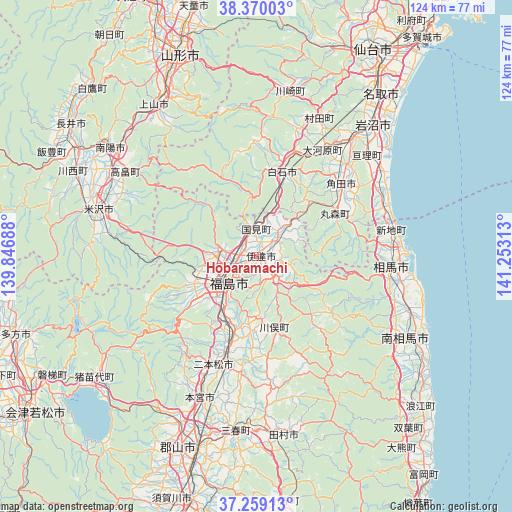
Hobaramachi GPS coordinates[2]
37° 49' 0.012" North, 140° 33' 0" East
| Map corner | latitude | longitude |
|---|---|---|
| Upper-left | 38.37003°, | 139.84688° |
| Center: | 37.81667°, | 140.55° |
| Lower-right: | 37.25913°, | 141.25313° |
| Map W x H: | 123.5×123.5 km | = 76.7×76.7mi |
| max Lat: | 45.40944° ⇑13.9% North |
| Hobaramachi: | 37.81667° |
| min Lat: | ⇓86.1% South 24.34478° |
| min Long | Hobaramachi | max Long |
| 123° | 140.55° | 145.575° |
| W 87.8%⇐ | ⇒12.2% E |
Elevation
Elevation of Hobaramachi is 51 m = 167 ft, and this is 33.6 m = 110 ft below average elevation for this country.
| Max E: |
1086 m = 3563 ft | 37.4% |
| Avg. | 84.6 m = 278 ft | |
| Hobaramachi | 51 m = 167 ft | |
Min E: |
-2 m = -7 ft | 62.6% |
See also: Japan elevation on elevation.city.
Geographical zone
Hobaramachi is located in North temperate zone (between Tropic of Cancer and the Arctic Circle). Distance of this Northern Tropic circle is 1598.9 km =993.5 mi to South.| Distance of | km | miles | from Hobaramachi |
|---|---|---|---|
| North Pole | 5802.2 | 3605.3 | to North |
| Arctic Circle | 3196.4 | 1986.2 | to North |
| Tropic Cancer | 1598.9 | 993.5 | to South |
| Equator | 4204.8 | 2612.7 | to South |


Nearby cities:
15 places around Hobaramachi: (largest is in red/bold)
• Date
4.4 km =2.7 mi,  270°
270°
• Fukushima
10.4 km =6.5 mi,  224°
224°
• Funehikimachi-funehiki
41.1 km =25.5 mi,  176°
176°
• Iwanuma
42 km =26.1 mi,  40°
40°
• Kakuda
26.2 km =16.3 mi,  47°
47°
• Marumori
22 km =13.7 mi,  59°
59°
• Motomiya
36.1 km =22.4 mi,  201°
201°
• Nihommatsu
27.9 km =17.3 mi, 201°
• Shiroishi
21.6 km =13.4 mi,  16°
16°
• Sōma
33.4 km =20.8 mi,  94°
94°
• Takahata
37.7 km =23.4 mi,  303°
303°
• Watari
35.9 km =22.3 mi, 47°
• Yanagawamachi-saiwaichō
5.7 km =3.5 mi, 49°
• Yonezawa
39.4 km =24.5 mi,  285°
285°
• Ōkawara
30.5 km =19 mi,  31°
31°
Sources, notices
• [Note1] Compared only with cities in Japan existing in our database
• [Src1] Map data: © OpenStreetMap contributors (CC-BY-SA)
• [Src2] Other city data from geonames.org with taken over terms of usage.
• [Src3] Geographical zone / Annual Mean Temperature by Robert A. Rohde @ Wikipedia
