Tsuchiura geodata
Tsuchiura (Ibaraki) is a seat of a second-order administrative division; located in Japan in Asia/Tokyo (GMT+9) time zone. In our database, there are 767 cities with bigger population. Compared to other cities in Japan, 69.4% of cities are located further ↓South; 82.2% of cities are located further ←West and 89.6% of cities have higher elevation than Tsuchiura. Note1


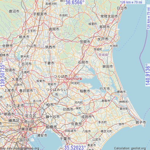
Tsuchiura GPS coordinates[2]
36° 5' 25.692" North, 140° 12' 37.692" East
| Map corner | latitude | longitude |
|---|---|---|
| Upper-left | 36.6566°, | 139.50735° |
| Center: | 36.09047°, | 140.21047° |
| Lower-right: | 35.52023°, | 140.9136° |
| Map W x H: | 126.4×126.4 km | = 78.5×78.5mi |
| max Lat: | 45.40944° ⇑30.6% North |
| Tsuchiura: | 36.09047° |
| min Lat: | ⇓69.4% South 24.34478° |
| min Long | Tsuchiura | max Long |
| 123° | 140.21047° | 145.575° |
| W 82.2%⇐ | ⇒17.8% E |
Elevation
Elevation of Tsuchiura is 5 m = 16 ft, and this is 79.6 m = 261 ft below average elevation for this country.
| Max E: |
1086 m = 3563 ft | 89.6% |
| Avg. | 84.6 m = 278 ft | |
| Tsuchiura | 5 m = 16 ft | |
Min E: |
-2 m = -7 ft | 10.4% |
See also: Japan elevation on elevation.city.
Geographical zone
Tsuchiura is located in North temperate zone (between Tropic of Cancer and the Arctic Circle). Distance of this Northern Tropic circle is 1407 km =874.3 mi to South.| Distance of | km | miles | from Tsuchiura |
|---|---|---|---|
| North Pole | 5994.2 | 3724.6 | to North |
| Arctic Circle | 3388.3 | 2105.4 | to North |
| Tropic Cancer | 1407 | 874.3 | to South |
| Equator | 4012.9 | 2493.5 | to South |


Nearby cities:
15 places around Tsuchiura: (largest is in red/bold)
• Ami
6.4 km =4 mi,  188°
188°
• Edosaki
18.3 km =11.4 mi,  148°
148°
• Fujishiro
21.1 km =13.1 mi,  203°
203°
• Inashiki
18.1 km =11.2 mi, 145°
• Ishige
22.1 km =13.7 mi,  277°
277°
• Ishioka
11.5 km =7.1 mi,  26°
26°
• Kasumigaura
7.7 km =4.8 mi,  24°
24°
• Makabe
22 km =13.7 mi,  333°
333°
• Mitsukaidō
22 km =13.7 mi,  248°
248°
• Naka
6 km =3.7 mi,  221°
221°
• Ryūgasaki
21.3 km =13.2 mi, 186°
• Sakuragawa
19.7 km =12.2 mi, 334°
• Tsukuba
15.7 km =9.8 mi,  320°
320°
• Tsukubamirai
21.6 km =13.4 mi,  236°
236°
• Ushiku
15.4 km =9.6 mi,  206°
206°
Sources, notices
• [Note1] Compared only with cities in Japan existing in our database
• [Src1] Map data: © OpenStreetMap contributors (CC-BY-SA)
• [Src2] Other city data from geonames.org with taken over terms of usage.
• [Src3] Geographical zone / Annual Mean Temperature by Robert A. Rohde @ Wikipedia
