Koah Thum geodata
Koah Thum (Kandal) is a seat of a second-order administrative division; located in Cambodia in Asia/Phnom_Penh (GMT+7) time zone. In our database, there are 29 cities with bigger population. Compared to other cities in Cambodia, 82.6% of cities are located further ↑North; 68.9% of cities are located further ←West and 77.3% of cities have higher elevation than Koah Thum. Note1


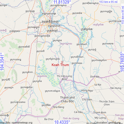
Koah Thum GPS coordinates[2]
11° 7' 27.156" North, 105° 3' 25.992" East
| Map corner | latitude | longitude |
|---|---|---|
| Upper-left | 11.81329°, | 104.3541° |
| Center: | 11.12421°, | 105.05722° |
| Lower-right: | 10.4335°, | 105.76035° |
| Map W x H: | 153.4×153.4 km | = 95.3×95.3mi |
| max Lat: | 14.23223° ⇑82.6% North |
| Koah Thum: | 11.12421° |
| min Lat: | ⇓17.4% South 10.48291° |
| min Long | Koah Thum | max Long |
| 102.37574° | 105.05722° | 107.42393° |
| W 68.9%⇐ | ⇒31.1% E |
Elevation
Elevation of Koah Thum is 13 m = 43 ft, and this is 39 m = 128 ft below average elevation for this country.
| Max E: |
678 m = 2224 ft | 77.3% |
| Avg. | 52 m = 171 ft | |
| Koah Thum | 13 m = 43 ft | |
Min E: |
4 m = 13 ft | 22.7% |
See also: Cambodia elevation on elevation.city.
Geographical zone
Koah Thum is located in North Torrid zone (between Equator and Tropic of Cancer). Distance of Equator is 1236.9 km =768.6 mi to South.| Distance of | km | miles | from Koah Thum |
|---|---|---|---|
| North Pole | 8770.2 | 5449.5 | to North |
| Arctic Circle | 6164.3 | 3830.3 | to North |
| Tropic Cancer | 1369 | 850.7 | to North |
| Equator | 1236.9 | 768.6 | to South |


Nearby cities:
15 places around Koah Thum: (largest is in red/bold)
• Bourei Cholsar
32.5 km =20.2 mi,  187°
187°
• Kampong Trabaek
46.5 km =28.9 mi,  87°
87°
• Kandal Stueng
40.8 km =25.4 mi,  321°
321°
• Leuk Daek
19.6 km =12.2 mi,  73°
73°
• Mean Chey
47.3 km =29.4 mi,  343°
343°
• Peam Chor
18.1 km =11.2 mi,  98°
98°
• Peam Ro
32.1 km =19.9 mi,  50°
50°
• Phumĭ Véal Srê
34.4 km =21.4 mi,  242°
242°
• Preah Sdach
35.9 km =22.3 mi, 95°
• Prey Veng
49.8 km =30.9 mi,  35°
35°
• S’ang
26.8 km =16.7 mi,  348°
348°
• Ta Khmau
37.8 km =23.5 mi, 341°
• Ta Khmau
41.6 km =25.8 mi, 343°
• Takeo
33.2 km =20.6 mi, 243°
• Tram Kak
43.4 km =27 mi,  253°
253°
Sources, notices
• [Note1] Compared only with cities in Cambodia existing in our database
• [Src1] Map data: © OpenStreetMap contributors (CC-BY-SA)
• [Src2] Other city data from geonames.org with taken over terms of usage.
• [Src3] Geographical zone / Annual Mean Temperature by Robert A. Rohde @ Wikipedia
