Phumĭ Véal Srê geodata
Phumĭ Véal Srê (Takeo) is a populated place; located in Cambodia in Asia/Phnom_Penh (GMT+7) time zone. With population of 44,270 people, there are 10 cities with bigger population in this country. Compared to other cities in Cambodia, 90.2% of cities are located further ↑North; 53.8% of cities are located further ←West and 82.6% of cities have higher elevation than Phumĭ Véal Srê. Note1


Phumĭ Véal Srê GPS coordinates[2]
10° 58' 50.916" North, 104° 46' 41.808" East
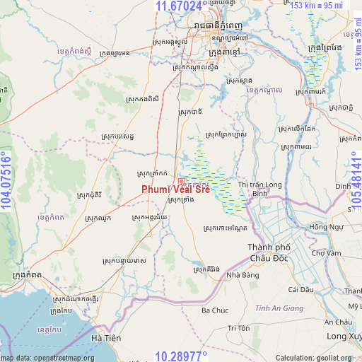
| Map corner | latitude | longitude |
|---|---|---|
| Upper-left | 11.67024°, | 104.07516° |
| Center: | 10.98081°, | 104.77828° |
| Lower-right: | 10.28977°, | 105.48141° |
| Map W x H: | 153.5×153.5 km | = 95.4×95.4mi |
| max Lat: | 14.23223° ⇑90.2% North |
| Phumĭ Véal Srê: | 10.98081° |
| min Lat: | ⇓9.8% South 10.48291° |
| min Long | Phumĭ Véal Sr | max Long |
| 102.37574° | 104.77828° | 107.42393° |
| W 53.8%⇐ | ⇒46.2% E |
Elevation
Elevation of Phumĭ Véal Srê is 10 m = 33 ft, and this is 42 m = 138 ft below average elevation for this country.
| Max E: |
678 m = 2224 ft | 82.6% |
| Avg. | 52 m = 171 ft | |
| Phumĭ Véal Srê | 10 m = 33 ft | |
Min E: |
4 m = 13 ft | 17.4% |
See also: Phumĭ Véal Srê elevation on elevation.city.
Geographical zone
Phumĭ Véal Srê is located in North Torrid zone (between Equator and Tropic of Cancer). Distance of Equator is 1221 km =758.7 mi to South.| Distance of | km | miles | from Phumĭ Véal Srê |
|---|---|---|---|
| North Pole | 8786.1 | 5459.4 | to North |
| Arctic Circle | 6180.2 | 3840.2 | to North |
| Tropic Cancer | 1385 | 860.6 | to North |
| Equator | 1221 | 758.7 | to South |


Nearby cities:
15 places around Phumĭ Véal Srê: (largest is in red/bold)
• Banteay Meas
42.2 km =26.2 mi,  214°
214°
• Basedth
32.4 km =20.1 mi,  305°
305°
• Bourei Cholsar
30.9 km =19.2 mi,  121°
121°
• Chhuk
38.7 km =24 mi,  245°
245°
• Chum Kiri
39.4 km =24.5 mi,  260°
260°
• Kampong Trach
57.9 km =36 mi,  215°
215°
• Kandal Stueng
48.4 km =30.1 mi,  6°
6°
• Kiri Vongs
39.5 km =24.5 mi,  164°
164°
• Koah Thum
34.4 km =21.4 mi,  62°
62°
• Leuk Daek
53.7 km =33.4 mi,  66°
66°
• Peam Chor
50.1 km =31.1 mi, 74°
• S’ang
49.1 km =30.5 mi,  30°
30°
• Ta Khmau
54.9 km =34.1 mi,  19°
19°
• Takeo
1.3 km =0.8 mi, 33°
• Tram Kak
11.6 km =7.2 mi,  287°
287°
Sources, notices
• [Note1] Compared only with cities in Cambodia existing in our database
• [Src1] Map data: © OpenStreetMap contributors (CC-BY-SA)
• [Src2] Other city data from geonames.org with taken over terms of usage.
• [Src3] Geographical zone / Annual Mean Temperature by Robert A. Rohde @ Wikipedia
