Basedth geodata
Basedth (Kampong Speu) is a seat of a second-order administrative division; located in Cambodia in Asia/Phnom_Penh (GMT+7) time zone. In our database, there are 29 cities with bigger population. Compared to other cities in Cambodia, 81.1% of cities are located further ↑North; 52.3% of cities are located further →East and 73.5% of cities have lower elevation than Basedth. Note1


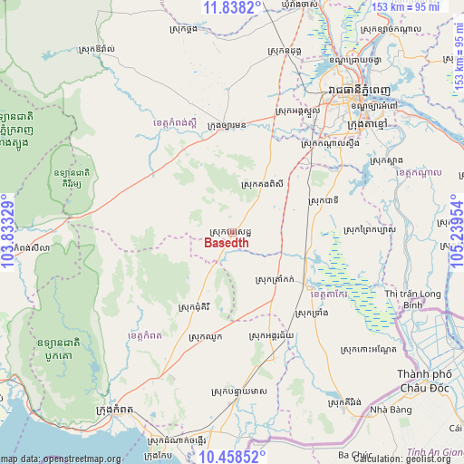
Basedth GPS coordinates[2]
11° 8' 57.048" North, 104° 32' 11.076" East
| Map corner | latitude | longitude |
|---|---|---|
| Upper-left | 11.8382°, | 103.83329° |
| Center: | 11.14918°, | 104.53641° |
| Lower-right: | 10.45852°, | 105.23954° |
| Map W x H: | 153.4×153.4 km | = 95.3×95.3mi |
| max Lat: | 14.23223° ⇑81.1% North |
| Basedth: | 11.14918° |
| min Lat: | ⇓18.9% South 10.48291° |
| min Long | Basedth | max Long |
| 102.37574° | 104.53641° | 107.42393° |
| W 47.7%⇐ | ⇒52.3% E |
Elevation
Elevation of Basedth is 44 m = 144 ft, and this is 8 m = 26 ft below average elevation for this country.
| Max E: |
678 m = 2224 ft | 26.5% |
| Avg. | 52 m = 171 ft | |
| Basedth | 44 m = 144 ft | |
Min E: |
4 m = 13 ft | 73.5% |
See also: Cambodia elevation on elevation.city.
Geographical zone
Basedth is located in North Torrid zone (between Equator and Tropic of Cancer). Distance of Equator is 1239.7 km =770.3 mi to South.| Distance of | km | miles | from Basedth |
|---|---|---|---|
| North Pole | 8767.4 | 5447.8 | to North |
| Arctic Circle | 6161.5 | 3828.6 | to North |
| Tropic Cancer | 1366.2 | 848.9 | to North |
| Equator | 1239.7 | 770.3 | to South |


Nearby cities:
15 places around Basedth: (largest is in red/bold)
• Banteay Meas
53.6 km =33.3 mi,  177°
177°
• Chhuk
35.9 km =22.3 mi,  194°
194°
• Chum Kiri
27.9 km =17.3 mi,  206°
206°
• Dangkao
57.6 km =35.8 mi,  37°
37°
• Kampong Speu
33.9 km =21.1 mi,  357°
357°
• Kandal Stueng
43.2 km =26.8 mi,  47°
47°
• Koah Thum
56.9 km =35.4 mi,  92°
92°
• Mean Chey
61 km =37.9 mi, 45°
• Phnum Sruoch
31.8 km =19.8 mi,  325°
325°
• Phumĭ Véal Srê
32.4 km =20.1 mi,  125°
125°
• S’ang
56.5 km =35.1 mi,  65°
65°
• Ta Khmau
55.5 km =34.5 mi, 53°
• Ta Khmau
58.4 km =36.3 mi, 50°
• Takeo
32.3 km =20.1 mi,  122°
122°
• Tram Kak
21.6 km =13.4 mi,  135°
135°
Sources, notices
• [Note1] Compared only with cities in Cambodia existing in our database
• [Src1] Map data: © OpenStreetMap contributors (CC-BY-SA)
• [Src2] Other city data from geonames.org with taken over terms of usage.
• [Src3] Geographical zone / Annual Mean Temperature by Robert A. Rohde @ Wikipedia
