Koas Krala geodata
Koas Krala (Battambang) is a seat of a second-order administrative division; located in Cambodia in Asia/Phnom_Penh (GMT+7) time zone. In our database, there are 29 cities with bigger population. Compared to other cities in Cambodia, 62.1% of cities are located further ↓South; 81.1% of cities are located further →East and 60.6% of cities have lower elevation than Koas Krala. Note1


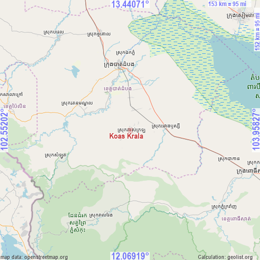
Koas Krala GPS coordinates[2]
12° 45' 21.168" North, 103° 15' 18.504" East
| Map corner | latitude | longitude |
|---|---|---|
| Upper-left | 13.44071°, | 102.55202° |
| Center: | 12.75588°, | 103.25514° |
| Lower-right: | 12.06919°, | 103.95827° |
| Map W x H: | 152.5×152.5 km | = 94.8×94.8mi |
| max Lat: | 14.23223° ⇑37.9% North |
| Koas Krala: | 12.75588° |
| min Lat: | ⇓62.1% South 10.48291° |
| min Long | Koas Krala | max Long |
| 102.37574° | 103.25514° | 107.42393° |
| W 18.9%⇐ | ⇒81.1% E |
Elevation
Elevation of Koas Krala is 27 m = 89 ft, and this is 25 m = 82 ft below average elevation for this country.
| Max E: |
678 m = 2224 ft | 39.4% |
| Avg. | 52 m = 171 ft | |
| Koas Krala | 27 m = 89 ft | |
Min E: |
4 m = 13 ft | 60.6% |
See also: Cambodia elevation on elevation.city.
Geographical zone
Koas Krala is located in North Torrid zone (between Equator and Tropic of Cancer). Distance of this Northern Tropic circle is 1187.6 km =737.9 mi to North.| Distance of | km | miles | from Koas Krala |
|---|---|---|---|
| North Pole | 8588.7 | 5336.8 | to North |
| Arctic Circle | 5982.9 | 3717.6 | to North |
| Tropic Cancer | 1187.6 | 737.9 | to North |
| Equator | 1418.3 | 881.3 | to South |


Nearby cities:
15 places around Koas Krala: (largest is in red/bold)
• Aek Phnum
45 km =28 mi,  356°
356°
• Bakan
60.1 km =37.3 mi,  106°
106°
• Banan
23.8 km =14.8 mi,  329°
329°
• Bat Dambang
59.1 km =36.7 mi,  342°
342°
• Battambang
39.1 km =24.3 mi,  350°
350°
• Bavel
68.6 km =42.6 mi,  323°
323°
• Moung Ruessei
21.2 km =13.2 mi,  84°
84°
• Pailin
70.8 km =44 mi,  278°
278°
• Phnum Kravanh
71.7 km =44.6 mi,  128°
128°
• Pursat
76 km =47.2 mi, 108°
• Sala Krau
73.5 km =45.7 mi,  287°
287°
• Samlout
45.7 km =28.4 mi,  250°
250°
• Sangkae
36 km =22.4 mi, 358°
• Ta Loas
23 km =14.3 mi, 75°
• Veal Veaeng
52.8 km =32.8 mi,  198°
198°
Sources, notices
• [Note1] Compared only with cities in Cambodia existing in our database
• [Src1] Map data: © OpenStreetMap contributors (CC-BY-SA)
• [Src2] Other city data from geonames.org with taken over terms of usage.
• [Src3] Geographical zone / Annual Mean Temperature by Robert A. Rohde @ Wikipedia
