Ponhea Lueu geodata
Ponhea Lueu (Phnom Penh) is a seat of a second-order administrative division; located in Cambodia in Asia/Phnom_Penh (GMT+7) time zone. In our database, there are 29 cities with bigger population. Compared to other cities in Cambodia, 62.1% of cities are located further ↑North; 56.8% of cities are located further ←West and 72% of cities have higher elevation than Ponhea Lueu. Note1


Ponhea Lueu GPS coordinates[2]
11° 39' 20.772" North, 104° 52' 0.624" East
| Map corner | latitude | longitude |
|---|---|---|
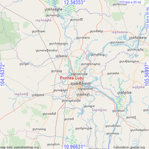
| Upper-left | 12.34353°, | 104.16372° |
| Center: | 11.65577°, | 104.86684° |
| Lower-right: | 10.96631°, | 105.56997° |
| Map W x H: | 153.1×153.1 km | = 95.1×95.1mi |
| max Lat: | 14.23223° ⇑62.1% North |
| Ponhea Lueu: | 11.65577° |
| min Lat: | ⇓37.9% South 10.48291° |
| min Long | Ponhea Lueu | max Long |
| 102.37574° | 104.86684° | 107.42393° |
| W 56.8%⇐ | ⇒43.2% E |
Elevation
Elevation of Ponhea Lueu is 16 m = 52 ft, and this is 36 m = 118 ft below average elevation for this country.
| Max E: |
678 m = 2224 ft | 72% |
| Avg. | 52 m = 171 ft | |
| Ponhea Lueu | 16 m = 52 ft | |
Min E: |
4 m = 13 ft | 28% |
See also: Cambodia elevation on elevation.city.
Geographical zone
Ponhea Lueu is located in North Torrid zone (between Equator and Tropic of Cancer). Distance of Equator is 1296 km =805.3 mi to South.| Distance of | km | miles | from Ponhea Lueu |
|---|---|---|---|
| North Pole | 8711.1 | 5412.8 | to North |
| Arctic Circle | 6105.2 | 3793.6 | to North |
| Tropic Cancer | 1309.9 | 813.9 | to North |
| Equator | 1296 | 805.3 | to South |


Nearby cities:
15 places around Ponhea Lueu: (largest is in red/bold)
• Batheay
38 km =23.6 mi,  12°
12°
• Cheung Prey
50 km =31.1 mi,  26°
26°
• Dangkao
10.5 km =6.5 mi,  186°
186°
• Kampong Speu
43.9 km =27.3 mi,  239°
239°
• Kandal Stueng
27.3 km =17 mi, 189°
• Mean Chey
15.7 km =9.8 mi,  150°
150°
• Mukh Kampul
14.9 km =9.3 mi,  53°
53°
• Odongk
18.5 km =11.5 mi,  279°
279°
• Phnom Penh
11.7 km =7.3 mi, 152°
• Prey Veng
53.4 km =33.2 mi,  110°
110°
• Ruessei Kaev
5.8 km =3.6 mi,  126°
126°
• S’ang
36.2 km =22.5 mi, 154°
• Ta Khmau
21.2 km =13.2 mi, 154°
• Ta Khmau
24.8 km =15.4 mi,  159°
159°
• Thpong
49.1 km =30.5 mi, 282°
Sources, notices
• [Note1] Compared only with cities in Cambodia existing in our database
• [Src1] Map data: © OpenStreetMap contributors (CC-BY-SA)
• [Src2] Other city data from geonames.org with taken over terms of usage.
• [Src3] Geographical zone / Annual Mean Temperature by Robert A. Rohde @ Wikipedia
