Utiroa Village geodata
Utiroa Village (Gilbert Islands) is a populated place; located in Kiribati in Pacific/Tarawa (GMT+12) time zone. With population of 571 people, there are 29 cities with bigger population in this country. Compared to other cities in Kiribati, 91.4% of cities are located further ↑North; 91.4% of cities are located further ←West and 60% of cities have lower elevation than Utiroa Village. Note1


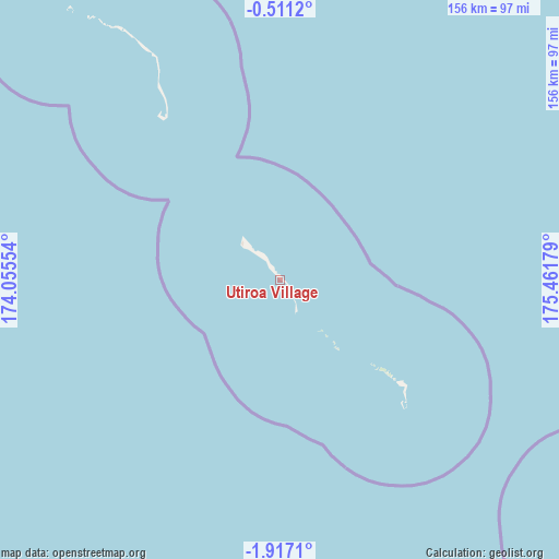
Utiroa Village GPS coordinates[2]
1° 12' 51.264" South, 174° 45' 31.176" East
| Map corner | latitude | longitude |
|---|---|---|
| Upper-left | -0.5112°, | 174.05554° |
| Center: | -1.21424°, | 174.75866° |
| Lower-right: | -1.9171°, | 175.46179° |
| Map W x H: | 156.3×156.3 km | = 97.1×97.1mi |
| max Lat: | 3.90806° ⇑91.4% North |
| Utiroa Village: | -1.21424° |
| min Lat: | ⇓8.6% South -2.65512° |
| min Long | Utiroa Village | max Long |
| -159.38832° | 174.75866° | 176.83302° |
| W 91.4%⇐ | ⇒8.6% E |
Elevation
Elevation of Utiroa Village is 11 m = 36 ft, and this is 1.1 m = 4 ft above average elevation for this country.
| Max E: |
13 m = 43 ft | 40% |
| Utiroa Village | 11 m 36 ft | |
| Avg. | 9.9 m = 32 ft | |
Min E: |
6 m = 20 ft | 60% |
See also: Kiribati elevation on elevation.city.
Geographical zone
Utiroa Village is located in South Torrid zone (between Equator and Tropic of Capricorn). Distance of Equator is 135 km =83.9 mi to North.| Distance of | km | miles | from Utiroa Village |
|---|---|---|---|
| Equator | 135 | 83.9 | to North |
| Tropic Capricorn | 2470.9 | 1535.3 | to South |
| Antarctic Circle | 7266.2 | 4515 | to South |
| South Pole | 9872.1 | 6134.2 | to South |


Nearby cities:
15 places around Utiroa Village: (largest is in red/bold)
• Abarao Village
340.2 km =211.4 mi,  327°
327°
• Bakaka Village
197.1 km =122.5 mi,  136°
136°
• Bikenibeu Village
339.7 km =211.1 mi, 327°
• Bonriki Village
340.1 km =211.3 mi, 328°
• Buariki Village
198.7 km =123.5 mi,  321°
321°
• Eita Village
5.3 km =3.3 mi, 319°
• Matang Village
69.5 km =43.2 mi, 330°
• Nawerewere Village
338.5 km =210.3 mi, 327°
• Roreti Village
280.7 km =174.4 mi,  124°
124°
• Rotuma Village
75.3 km =46.8 mi, 329°
• Rungata
187 km =116.2 mi,  94°
94°
• Tabiang Village
215.4 km =133.8 mi, 331°
• Tanaeang Village
12.4 km =7.7 mi,  313°
313°
• Temaiku Village
337.1 km =209.5 mi, 328°
• Toboiaki Village
62.8 km =39 mi, 327°
Sources, notices
• [Note1] Compared only with cities in Kiribati existing in our database
• [Src1] Map data: © OpenStreetMap contributors (CC-BY-SA)
• [Src2] Other city data from geonames.org with taken over terms of usage.
• [Src3] Geographical zone / Annual Mean Temperature by Robert A. Rohde @ Wikipedia
