Panda geodata
Panda (Grande Comore) is a populated place; located in Comoros in Indian/Comoro (GMT+3) time zone. With population of 899 people, there are 92 cities with bigger population in this country. Compared to other cities in Comoros, 53.1% of cities are located further ↓South; 61.1% of cities are located further →East and 76.1% of cities have lower elevation than Panda. Note1


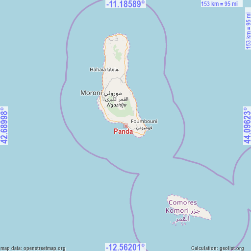
Panda GPS coordinates[2]
11° 52' 29.352" South, 43° 23' 35.16" East
| Map corner | latitude | longitude |
|---|---|---|
| Upper-left | -11.18589°, | 42.68998° |
| Center: | -11.87482°, | 43.3931° |
| Lower-right: | -12.56201°, | 44.09623° |
| Map W x H: | 153×153 km | = 95.1×95.1mi |
| max Lat: | -11.38472° ⇑46.9% North |
| Panda: | -11.87482° |
| min Lat: | ⇓53.1% South -12.37306° |
| min Long | Panda | max Long |
| 43.2525° | 43.3931° | 44.53194° |
| W 38.9%⇐ | ⇒61.1% E |
Elevation
Elevation of Panda is 283 m = 928 ft, and this is 86.9 m = 285 ft above average elevation for this country.
| Max E: |
924 m = 3031 ft | 23.9% |
| Panda | 283 m 928 ft | |
| Avg. | 196.1 m = 643 ft | |
Min E: |
1 m = 3 ft | 76.1% |
See also: Comoros elevation on elevation.city.
Geographical zone
Panda is located in South Torrid zone (between Equator and Tropic of Capricorn). Distance of this Southern Tropic circle is 1285.6 km =798.8 mi to South.| Distance of | km | miles | from Panda |
|---|---|---|---|
| Equator | 1320.4 | 820.5 | to North |
| Tropic Capricorn | 1285.6 | 798.8 | to South |
| Antarctic Circle | 6080.8 | 3778.4 | to South |
| South Pole | 8686.7 | 5397.7 | to South |


Nearby cities:
15 places around Panda: (largest is in red/bold)
• Chindini
11.9 km =7.4 mi,  116°
116°
• Chouani
12.2 km =7.6 mi,  298°
298°
• Dembéni
0.5 km =0.3 mi,  75°
75°
• Dima
2.3 km =1.4 mi, 123°
• Dzahadjou
5.3 km =3.3 mi, 297°
• Foumbouni
11.2 km =7 mi, 84°
• Hetsa
9 km =5.6 mi,  291°
291°
• Kové
8.6 km =5.3 mi,  90°
90°
• Madjeouéni
13.8 km =8.6 mi, 295°
• Mbambani
6.1 km =3.8 mi, 293°
• Mdjoyézi
9.6 km =6 mi, 296°
• Mohoro
8.5 km =5.3 mi,  51°
51°
• Nioumamilima
6.2 km =3.9 mi,  68°
68°
• Ourovéni
12.2 km =7.6 mi,  110°
110°
• Singani
8.8 km =5.5 mi, 289°
Sources, notices
• [Note1] Compared only with cities in Comoros existing in our database
• [Src1] Map data: © OpenStreetMap contributors (CC-BY-SA)
• [Src2] Other city data from geonames.org with taken over terms of usage.
• [Src3] Geographical zone / Annual Mean Temperature by Robert A. Rohde @ Wikipedia
