Hetsa geodata
Hetsa (Grande Comore) is a populated place; located in Comoros in Indian/Comoro (GMT+3) time zone. With population of 785 people, there are 99 cities with bigger population in this country. Compared to other cities in Comoros, 59.3% of cities are located further ↓South; 74.3% of cities are located further →East and 58.4% of cities have lower elevation than Hetsa. Note1


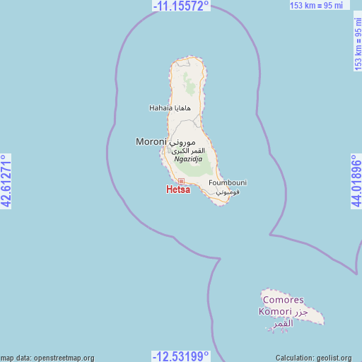
Hetsa GPS coordinates[2]
11° 50' 40.992" South, 43° 18' 56.988" East
| Map corner | latitude | longitude |
|---|---|---|
| Upper-left | -11.15572°, | 42.61271° |
| Center: | -11.84472°, | 43.31583° |
| Lower-right: | -12.53199°, | 44.01896° |
| Map W x H: | 153×153 km | = 95.1×95.1mi |
| max Lat: | -11.38472° ⇑40.7% North |
| Hetsa: | -11.84472° |
| min Lat: | ⇓59.3% South -12.37306° |
| min Long | Hetsa | max Long |
| 43.2525° | 43.31583° | 44.53194° |
| W 25.7%⇐ | ⇒74.3% E |
Elevation
Elevation of Hetsa is 162 m = 531 ft, and this is 34.1 m = 112 ft below average elevation for this country.
| Max E: |
924 m = 3031 ft | 41.6% |
| Avg. | 196.1 m = 643 ft | |
| Hetsa | 162 m = 531 ft | |
Min E: |
1 m = 3 ft | 58.4% |
See also: Comoros elevation on elevation.city.
Geographical zone
Hetsa is located in South Torrid zone (between Equator and Tropic of Capricorn). Distance of this Southern Tropic circle is 1288.9 km =800.9 mi to South.| Distance of | km | miles | from Hetsa |
|---|---|---|---|
| Equator | 1317 | 818.3 | to North |
| Tropic Capricorn | 1288.9 | 800.9 | to South |
| Antarctic Circle | 6084.2 | 3780.5 | to South |
| South Pole | 8690.1 | 5399.8 | to South |


Nearby cities:
15 places around Hetsa: (largest is in red/bold)
• Chouani
3.3 km =2.1 mi,  315°
315°
• Dembéni
9.5 km =5.9 mi,  109°
109°
• Dima
11.3 km =7 mi, 114°
• Dzahadjou
3.8 km =2.4 mi,  103°
103°
• Madjeouéni
4.8 km =3 mi,  301°
301°
• Mbambani
2.9 km =1.8 mi, 106°
• Mdjoyézi
0.9 km =0.6 mi,  347°
347°
• Mitsoudjé
5.3 km =3.3 mi,  313°
313°
• Mohoro
15.2 km =9.4 mi,  82°
82°
• Mvouni
15.3 km =9.5 mi,  338°
338°
• Nioumamilima
14.2 km =8.8 mi,  94°
94°
• Panda
9 km =5.6 mi, 111°
• Salimani
6.4 km =4 mi, 305°
• Singani
0.4 km =0.2 mi,  155°
155°
• Séléa
9 km =5.6 mi, 318°
Sources, notices
• [Note1] Compared only with cities in Comoros existing in our database
• [Src1] Map data: © OpenStreetMap contributors (CC-BY-SA)
• [Src2] Other city data from geonames.org with taken over terms of usage.
• [Src3] Geographical zone / Annual Mean Temperature by Robert A. Rohde @ Wikipedia
