Kimje geodata
Kimje (Jeollabuk-do) is a populated place; located in South Korea in Asia/Seoul (GMT+9) time zone. With population of 44,894 people, there are 86 cities with bigger population in this country. Compared to other cities in South Korea, 54.2% of cities are located further ↑North; 72.4% of cities are located further →East and 75.5% of cities have higher elevation than Kimje. Note1


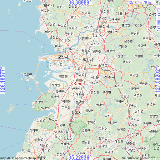
Kimje GPS coordinates[2]
35° 48' 6.012" North, 126° 53' 20.004" East
| Map corner | latitude | longitude |
|---|---|---|
| Upper-left | 36.36989°, | 126.18577° |
| Center: | 35.80167°, | 126.88889° |
| Lower-right: | 35.22936°, | 127.59202° |
| Map W x H: | 126.8×126.8 km | = 78.8×78.8mi |
| max Lat: | 38.37881° ⇑54.2% North |
| Kimje: | 35.80167° |
| min Lat: | ⇓45.8% South 33.25333° |
| min Long | Kimje | max Long |
| 126.10863° | 126.88889° | 129.55377° |
| W 27.6%⇐ | ⇒72.4% E |
Elevation
Elevation of Kimje is 18 m = 59 ft, and this is 52.4 m = 172 ft below average elevation for this country.
| Max E: |
691 m = 2267 ft | 75.5% |
| Avg. | 70.4 m = 231 ft | |
| Kimje | 18 m = 59 ft | |
Min E: |
1 m = 3 ft | 24.5% |
See also: Kimje elevation on elevation.city.
Geographical zone
Kimje is located in North temperate zone (between Tropic of Cancer and the Arctic Circle). Distance of this Northern Tropic circle is 1374.9 km =854.3 mi to South.| Distance of | km | miles | from Kimje |
|---|---|---|---|
| North Pole | 6026.3 | 3744.6 | to North |
| Arctic Circle | 3420.4 | 2125.3 | to North |
| Tropic Cancer | 1374.9 | 854.3 | to South |
| Equator | 3980.8 | 2473.6 | to South |


Nearby cities:
15 places around Kimje: (largest is in red/bold)
• Chilbo
24 km =14.9 mi,  156°
156°
• Gangjin
39.1 km =24.3 mi,  140°
140°
• Gunsan
25.4 km =15.8 mi,  320°
320°
• Gurim
43.2 km =26.8 mi,  153°
153°
• Gwanchon
37.2 km =23.1 mi,  112°
112°
• Iksan
16.9 km =10.5 mi,  20°
20°
• Imsil
41 km =25.5 mi,  120°
120°
• Jeongeup
22.6 km =14 mi,  173°
173°
• Jeonju
23.6 km =14.7 mi,  84°
84°
• Puan
16.4 km =10.2 mi,  239°
239°
• Sannae
29 km =18 mi, 153°
• Simwon
43.4 km =27 mi,  224°
224°
• Ssangchi
34.9 km =21.7 mi, 162°
• Wanju
23.8 km =14.8 mi, 78°
• Yŏnmu
41.1 km =25.5 mi,  27°
27°
Sources, notices
• [Note1] Compared only with cities in South Korea existing in our database
• [Src1] Map data: © OpenStreetMap contributors (CC-BY-SA)
• [Src2] Other city data from geonames.org with taken over terms of usage.
• [Src3] Geographical zone / Annual Mean Temperature by Robert A. Rohde @ Wikipedia
