Sannae geodata
Sannae (Jeollabuk-do) is a seat of a third-order administrative division; located in South Korea in Asia/Seoul (GMT+9) time zone. In our database, there are 128 cities with bigger population. Compared to other cities in South Korea, 58.7% of cities are located further ↑North; 64.3% of cities are located further →East and 93.4% of cities have lower elevation than Sannae. Note1


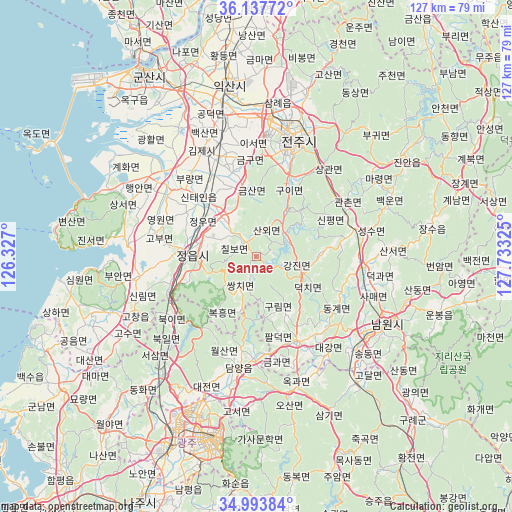
Sannae GPS coordinates[2]
35° 34' 4.152" North, 127° 1' 48.432" East
| Map corner | latitude | longitude |
|---|---|---|
| Upper-left | 36.13772°, | 126.327° |
| Center: | 35.56782°, | 127.03012° |
| Lower-right: | 34.99384°, | 127.73325° |
| Map W x H: | 127.2×127.2 km | = 79×79mi |
| max Lat: | 38.37881° ⇑58.7% North |
| Sannae: | 35.56782° |
| min Lat: | ⇓41.3% South 33.25333° |
| min Long | Sannae | max Long |
| 126.10863° | 127.03012° | 129.55377° |
| W 35.7%⇐ | ⇒64.3% E |
Elevation
Elevation of Sannae is 208 m = 682 ft, and this is 137.6 m = 451 ft above average elevation for this country.
| Max E: |
691 m = 2267 ft | 6.6% |
| Sannae | 208 m 682 ft | |
| Avg. | 70.4 m = 231 ft | |
Min E: |
1 m = 3 ft | 93.4% |
See also: South Korea elevation on elevation.city.
Geographical zone
Sannae is located in North temperate zone (between Tropic of Cancer and the Arctic Circle). Distance of this Northern Tropic circle is 1348.9 km =838.2 mi to South.| Distance of | km | miles | from Sannae |
|---|---|---|---|
| North Pole | 6052.3 | 3760.7 | to North |
| Arctic Circle | 3446.4 | 2141.5 | to North |
| Tropic Cancer | 1348.9 | 838.2 | to South |
| Equator | 3954.8 | 2457.4 | to South |


Nearby cities:
15 places around Sannae: (largest is in red/bold)
• Chilbo
5.1 km =3.2 mi,  319°
319°
• Damyang
28 km =17.4 mi,  188°
188°
• Donggye
23.8 km =14.8 mi,  126°
126°
• Gangjin
12.8 km =8 mi,  109°
109°
• Gurim
14.3 km =8.9 mi,  152°
152°
• Gwanchon
24.8 km =15.4 mi,  61°
61°
• Imsil
23.1 km =14.4 mi,  77°
77°
• Ingye
20 km =12.4 mi, 149°
• Jeongeup
10.8 km =6.7 mi,  289°
289°
• Jeonju
30.2 km =18.8 mi,  20°
20°
• Kimje
29 km =18 mi,  333°
333°
• Puan
32.3 km =20.1 mi,  303°
303°
• Seongsu
28.3 km =17.6 mi, 75°
• Ssangchi
7.7 km =4.8 mi,  198°
198°
• Wanju
32.6 km =20.3 mi, 18°
Sources, notices
• [Note1] Compared only with cities in South Korea existing in our database
• [Src1] Map data: © OpenStreetMap contributors (CC-BY-SA)
• [Src2] Other city data from geonames.org with taken over terms of usage.
• [Src3] Geographical zone / Annual Mean Temperature by Robert A. Rohde @ Wikipedia
