Hwasun geodata
Hwasun (Jeollanam-do) is a seat of a second-order administrative division; located in South Korea in Asia/Seoul (GMT+9) time zone. With population of 59,914 people, there are 76 cities with bigger population in this country. Compared to other cities in South Korea, 78.3% of cities are located further ↑North; 67.1% of cities are located further →East and 68.2% of cities have lower elevation than Hwasun. Note1


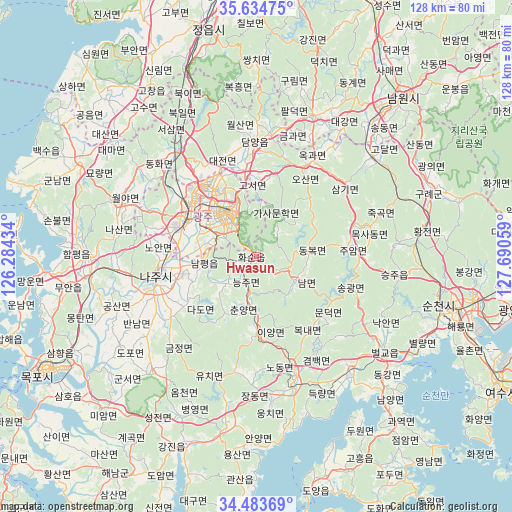
Hwasun GPS coordinates[2]
35° 3' 40.5" North, 126° 59' 14.856" East
| Map corner | latitude | longitude |
|---|---|---|
| Upper-left | 35.63475°, | 126.28434° |
| Center: | 35.06125°, | 126.98746° |
| Lower-right: | 34.48369°, | 127.69059° |
| Map W x H: | 128×128 km | = 79.5×79.5mi |
| max Lat: | 38.37881° ⇑78.3% North |
| Hwasun: | 35.06125° |
| min Lat: | ⇓21.7% South 33.25333° |
| min Long | Hwasun | max Long |
| 126.10863° | 126.98746° | 129.55377° |
| W 32.9%⇐ | ⇒67.1% E |
Elevation
Elevation of Hwasun is 75 m = 246 ft, and this is 4.6 m = 15 ft above average elevation for this country.
| Max E: |
691 m = 2267 ft | 31.8% |
| Hwasun | 75 m 246 ft | |
| Avg. | 70.4 m = 231 ft | |
Min E: |
1 m = 3 ft | 68.2% |
See also: Hwasun elevation on elevation.city.
Geographical zone
Hwasun is located in North temperate zone (between Tropic of Cancer and the Arctic Circle). Distance of this Northern Tropic circle is 1292.5 km =803.1 mi to South.| Distance of | km | miles | from Hwasun |
|---|---|---|---|
| North Pole | 6108.6 | 3795.7 | to North |
| Arctic Circle | 3502.7 | 2176.5 | to North |
| Tropic Cancer | 1292.5 | 803.1 | to South |
| Equator | 3898.4 | 2422.4 | to South |


Nearby cities:
15 places around Hwasun: (largest is in red/bold)
• Bongnae
22.8 km =14.2 mi,  144°
144°
• Changpyeong
20 km =12.4 mi,  7°
7°
• Cheongpung
20.6 km =12.8 mi,  184°
184°
• Dongbok
13 km =8.1 mi,  85°
85°
• Dongmyeon
5.7 km =3.5 mi,  126°
126°
• Gwangju
12.3 km =7.6 mi,  327°
327°
• Hancheolli
9.8 km =6.1 mi,  173°
173°
• Iyang
19.1 km =11.9 mi, 179°
• Juam
22.6 km =14 mi, 85°
• Masan
16 km =9.9 mi,  297°
297°
• Mundeok
22.3 km =13.9 mi, 130°
• Naju
24.8 km =15.4 mi,  261°
261°
• Nammyeon
11.5 km =7.1 mi,  120°
120°
• Seji
26.8 km =16.7 mi,  234°
234°
• Songgwang
26.9 km =16.7 mi,  110°
110°
Sources, notices
• [Note1] Compared only with cities in South Korea existing in our database
• [Src1] Map data: © OpenStreetMap contributors (CC-BY-SA)
• [Src2] Other city data from geonames.org with taken over terms of usage.
• [Src3] Geographical zone / Annual Mean Temperature by Robert A. Rohde @ Wikipedia
