Marijampolė geodata
Marijampolė (Marijampolė County) is a seat of a first-order administrative division; located in Lithuania in Europe/Vilnius (GMT+3) time zone. With population of 47,613 people, there are 8 cities with bigger population in this country. Compared to other cities in Lithuania, 91.8% of cities are located further ↑North; 66.4% of cities are located further →East and 67.2% of cities have higher elevation than Marijampolė. Note1


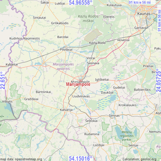
Marijampolė GPS coordinates[2]
54° 33' 35.676" North, 23° 21' 14.832" East
| Map corner | latitude | longitude |
|---|---|---|
| Upper-left | 54.96558°, | 22.651° |
| Center: | 54.55991°, | 23.35412° |
| Lower-right: | 54.15016°, | 24.05725° |
| Map W x H: | 90.7×90.7 km | = 56.4×56.4mi |
| max Lat: | 56.36149° ⇑91.8% North |
| Marijampolė: | 54.55991° |
| min Lat: | ⇓8.2% South 54.01573° |
| min Long | Marijampolė | max Long |
| 20.99651° | 23.35412° | 26.43984° |
| W 33.6%⇐ | ⇒66.4% E |
Elevation
Elevation of Marijampolė is 69 m = 226 ft, and this is 21.7 m = 71 ft below average elevation for this country.
| Max E: |
204 m = 669 ft | 67.2% |
| Avg. | 90.7 m = 298 ft | |
| Marijampolė | 69 m = 226 ft | |
Min E: |
-1 m = -3 ft | 32.8% |
See also: Marijampolė elevation on elevation.city.
Geographical zone
Marijampolė is located in North temperate zone (between Tropic of Cancer and the Arctic Circle). Distance of this North polar circle is 1334.7 km =829.3 mi to North.| Distance of | km | miles | from Marijampolė |
|---|---|---|---|
| North Pole | 3940.6 | 2448.6 | to North |
| Arctic Circle | 1334.7 | 829.3 | to North |
| Tropic Cancer | 3460.6 | 2150.3 | to South |
| Equator | 6066.5 | 3769.5 | to South |


Nearby cities:
15 places around Marijampolė: (largest is in red/bold)
• Birštonas
44.1 km =27.4 mi,  83°
83°
• Ežerėlis
39.4 km =24.5 mi,  24°
24°
• Garliava
44.2 km =27.5 mi,  48°
48°
• Kalvarija
18 km =11.2 mi,  208°
208°
• Kazlų Rūda
22.8 km =14.2 mi, 22°
• Kudirkos Naumiestis
39.6 km =24.6 mi,  306°
306°
• Kulautuva
46.3 km =28.8 mi, 23°
• Kybartai
39.1 km =24.3 mi,  282°
282°
• Lazdijai
37.8 km =23.5 mi,  164°
164°
• Linksmakalnis
43 km =26.7 mi,  59°
59°
• Mastaiciai
42.8 km =26.6 mi, 47°
• Prienai
39 km =24.2 mi, 77°
• Simnas
27.3 km =17 mi,  136°
136°
• Vilkaviskis
23.1 km =14.4 mi,  296°
296°
• Virbalis
35.1 km =21.8 mi, 282°
Sources, notices
• [Note1] Compared only with cities in Lithuania existing in our database
• [Src1] Map data: © OpenStreetMap contributors (CC-BY-SA)
• [Src2] Other city data from geonames.org with taken over terms of usage.
• [Src3] Geographical zone / Annual Mean Temperature by Robert A. Rohde @ Wikipedia
