Pilsrundāle geodata
Pilsrundāle (Rundāles) is a populated place; located in Latvia in Europe/Riga (GMT+3) time zone. With population of 900 people, there are 102 cities with bigger population in this country. Compared to other cities in Latvia, 85% of cities are located further ↑North; 70% of cities are located further →East and 73.6% of cities have higher elevation than Pilsrundāle. Note1


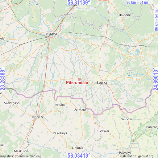
Pilsrundāle GPS coordinates[2]
56° 25' 30.108" North, 23° 59' 13.2" East
| Map corner | latitude | longitude |
|---|---|---|
| Upper-left | 56.81189°, | 23.28388° |
| Center: | 56.42503°, | 23.987° |
| Lower-right: | 56.03419°, | 24.69013° |
| Map W x H: | 86.5×86.5 km | = 53.7×53.7mi |
| max Lat: | 57.89752° ⇑85% North |
| Pilsrundāle: | 56.42503° |
| min Lat: | ⇓15% South 55.75284° |
| min Long | Pilsrundāle | max Long |
| 21.01085° | 23.987° | 28.12165° |
| W 30%⇐ | ⇒70% E |
Elevation
Elevation of Pilsrundāle is 22 m = 72 ft, and this is 43.4 m = 142 ft below average elevation for this country.
| Max E: |
212 m = 696 ft | 73.6% |
| Avg. | 65.4 m = 215 ft | |
| Pilsrundāle | 22 m = 72 ft | |
Min E: |
2 m = 7 ft | 26.4% |
See also: Latvia elevation on elevation.city.
Geographical zone
Pilsrundāle is located in North temperate zone (between Tropic of Cancer and the Arctic Circle). Distance of this North polar circle is 1127.3 km =700.5 mi to North.| Distance of | km | miles | from Pilsrundāle |
|---|---|---|---|
| North Pole | 3733.2 | 2319.7 | to North |
| Arctic Circle | 1127.3 | 700.5 | to North |
| Tropic Cancer | 3668 | 2279.2 | to South |
| Equator | 6273.9 | 3898.4 | to South |


Nearby cities:
15 places around Pilsrundāle: (largest is in red/bold)
• Baldone
43.6 km =27.1 mi,  35°
35°
• Baloži
50.8 km =31.6 mi,  9°
9°
• Bauska
12.9 km =8 mi,  98°
98°
• Dobele
48.9 km =30.4 mi,  296°
296°
• Iecava
23.5 km =14.6 mi, 35°
• Jelgava
30.1 km =18.7 mi,  326°
326°
• Mārupe
53.6 km =33.3 mi,  4°
4°
• Olaine
41.2 km =25.6 mi,  355°
355°
• Ozolnieki
32.2 km =20 mi,  336°
336°
• Pilsrundāle
2 km =1.2 mi,  113°
113°
• Tērvete
37.3 km =23.2 mi,  279°
279°
• Tīreļi
52.2 km =32.4 mi, 332°
• Vecumnieki
38.5 km =23.9 mi,  58°
58°
• Zelmeņi
39.1 km =24.3 mi,  274°
274°
• Ķekava
47.1 km =29.3 mi,  18°
18°
Sources, notices
• [Note1] Compared only with cities in Latvia existing in our database
• [Src1] Map data: © OpenStreetMap contributors (CC-BY-SA)
• [Src2] Other city data from geonames.org with taken over terms of usage.
• [Src3] Geographical zone / Annual Mean Temperature by Robert A. Rohde @ Wikipedia
