Pilsrundāle geodata
Pilsrundāle (Rundāles) is a seat of a first-order administrative division; located in Latvia in Europe/Riga (GMT+3) time zone. In our database, there are 110 cities with bigger population. Compared to other cities in Latvia, 86.4% of cities are located further ↑North; 69.3% of cities are located further →East and 70.7% of cities have higher elevation than Pilsrundāle. Note1


Pilsrundāle GPS coordinates[2]
56° 25' 5.232" North, 24° 0' 58.5" East
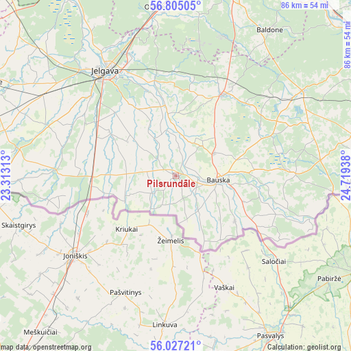
| Map corner | latitude | longitude |
|---|---|---|
| Upper-left | 56.80505°, | 23.31313° |
| Center: | 56.41812°, | 24.01625° |
| Lower-right: | 56.02721°, | 24.71938° |
| Map W x H: | 86.5×86.5 km | = 53.7×53.7mi |
| max Lat: | 57.89752° ⇑86.4% North |
| Pilsrundāle: | 56.41812° |
| min Lat: | ⇓13.6% South 55.75284° |
| min Long | Pilsrundāle | max Long |
| 21.01085° | 24.01625° | 28.12165° |
| W 30.7%⇐ | ⇒69.3% E |
Elevation
Elevation of Pilsrundāle is 28 m = 92 ft, and this is 37.4 m = 123 ft below average elevation for this country.
| Max E: |
212 m = 696 ft | 70.7% |
| Avg. | 65.4 m = 215 ft | |
| Pilsrundāle | 28 m = 92 ft | |
Min E: |
2 m = 7 ft | 29.3% |
See also: Latvia elevation on elevation.city.
Geographical zone
Pilsrundāle is located in North temperate zone (between Tropic of Cancer and the Arctic Circle). Distance of this North polar circle is 1128.1 km =701 mi to North.| Distance of | km | miles | from Pilsrundāle |
|---|---|---|---|
| North Pole | 3734 | 2320.2 | to North |
| Arctic Circle | 1128.1 | 701 | to North |
| Tropic Cancer | 3667.2 | 2278.7 | to South |
| Equator | 6273.1 | 3897.9 | to South |


Nearby cities:
15 places around Pilsrundāle: (largest is in red/bold)
• Baldone
43.3 km =26.9 mi,  32°
32°
• Baloži
51.3 km =31.9 mi,  6°
6°
• Bauska
11 km =6.8 mi,  95°
95°
• Dobele
50.9 km =31.6 mi,  296°
296°
• Iecava
23.2 km =14.4 mi, 30°
• Jelgava
31.8 km =19.8 mi,  324°
324°
• Olaine
42.2 km =26.2 mi,  353°
353°
• Ozolnieki
33.6 km =20.9 mi,  334°
334°
• Pilsrundāle
2 km =1.2 mi,  293°
293°
• Salaspils
53.6 km =33.3 mi,  23°
23°
• Tērvete
39.2 km =24.4 mi,  280°
280°
• Tīreļi
53.7 km =33.4 mi, 330°
• Vecumnieki
37.4 km =23.2 mi,  56°
56°
• Zelmeņi
41 km =25.5 mi, 275°
• Ķekava
47.3 km =29.4 mi, 16°
Sources, notices
• [Note1] Compared only with cities in Latvia existing in our database
• [Src1] Map data: © OpenStreetMap contributors (CC-BY-SA)
• [Src2] Other city data from geonames.org with taken over terms of usage.
• [Src3] Geographical zone / Annual Mean Temperature by Robert A. Rohde @ Wikipedia
