Bauska geodata
Bauska (Bauskas Rajons) is a seat of a first-order administrative division; located in Latvia in Europe/Riga (GMT+3) time zone. With population of 10,532 people, there are 20 cities with bigger population in this country. Compared to other cities in Latvia, 87.1% of cities are located further ↑North; 62.9% of cities are located further →East and 69.3% of cities have higher elevation than Bauska. Note1


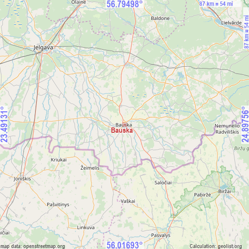
Bauska GPS coordinates[2]
56° 24' 28.584" North, 24° 11' 39.948" East
| Map corner | latitude | longitude |
|---|---|---|
| Upper-left | 56.79498°, | 23.49131° |
| Center: | 56.40794°, | 24.19443° |
| Lower-right: | 56.01693°, | 24.89756° |
| Map W x H: | 86.5×86.5 km | = 53.7×53.7mi |
| max Lat: | 57.89752° ⇑87.1% North |
| Bauska: | 56.40794° |
| min Lat: | ⇓12.9% South 55.75284° |
| min Long | Bauska | max Long |
| 21.01085° | 24.19443° | 28.12165° |
| W 37.1%⇐ | ⇒62.9% E |
Elevation
Elevation of Bauska is 30 m = 98 ft, and this is 35.4 m = 116 ft below average elevation for this country.
| Max E: |
212 m = 696 ft | 69.3% |
| Avg. | 65.4 m = 215 ft | |
| Bauska | 30 m = 98 ft | |
Min E: |
2 m = 7 ft | 30.7% |
See also: Latvia elevation on elevation.city.
Geographical zone
Bauska is located in North temperate zone (between Tropic of Cancer and the Arctic Circle). Distance of this North polar circle is 1129.2 km =701.7 mi to North.| Distance of | km | miles | from Bauska |
|---|---|---|---|
| North Pole | 3735.1 | 2320.9 | to North |
| Arctic Circle | 1129.2 | 701.7 | to North |
| Tropic Cancer | 3666.1 | 2278 | to South |
| Equator | 6272 | 3897.2 | to South |


Nearby cities:
15 places around Bauska: (largest is in red/bold)
• Baldone
39.5 km =24.5 mi,  18°
18°
• Iecava
21.1 km =13.1 mi,  2°
2°
• Ikšķile
50.9 km =31.6 mi, 21°
• Jelgava
40 km =24.9 mi,  312°
312°
• Lielvārde
51.2 km =31.8 mi,  47°
47°
• Olaine
45.8 km =28.5 mi,  339°
339°
• Ozolnieki
40.5 km =25.2 mi,  320°
320°
• Pilsrundāle
11 km =6.8 mi,  275°
275°
• Pilsrundāle
12.9 km =8 mi, 278°
• Salaspils
51.4 km =31.9 mi,  11°
11°
• Tērvete
50.1 km =31.1 mi, 279°
• Vecumnieki
29.8 km =18.5 mi,  42°
42°
• Zelmeņi
52 km =32.3 mi, 275°
• Ķegums
49.6 km =30.8 mi, 40°
• Ķekava
46.6 km =29 mi, 2°
Sources, notices
• [Note1] Compared only with cities in Latvia existing in our database
• [Src1] Map data: © OpenStreetMap contributors (CC-BY-SA)
• [Src2] Other city data from geonames.org with taken over terms of usage.
• [Src3] Geographical zone / Annual Mean Temperature by Robert A. Rohde @ Wikipedia
