Ustia geodata
Ustia (Dubăsari) is a populated place; located in Moldova in Europe/Chisinau (GMT+3) time zone. With population of 3,295 people, there are 63 cities with bigger population in this country. Compared to other cities in Moldova, 58.9% of cities are located further ↓South; 78.1% of cities are located further ←West and 90.4% of cities have higher elevation than Ustia. Note1


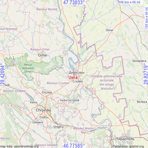
Ustia GPS coordinates[2]
47° 15' 18.864" North, 29° 7' 26.616" East
| Map corner | latitude | longitude |
|---|---|---|
| Upper-left | 47.73033°, | 28.42094° |
| Center: | 47.25524°, | 29.12406° |
| Lower-right: | 46.77585°, | 29.82719° |
| Map W x H: | 106.1×106.1 km | = 65.9×65.9mi |
| max Lat: | 48.43285° ⇑41.1% North |
| Ustia: | 47.25524° |
| min Lat: | ⇓58.9% South 45.48167° |
| min Long | Ustia | max Long |
| 27.07787° | 29.12406° | 29.9617° |
| W 78.1%⇐ | ⇒21.9% E |
Elevation
Elevation of Ustia is 25 m = 82 ft, and this is 67.8 m = 222 ft below average elevation for this country.
| Max E: |
241 m = 791 ft | 90.4% |
| Avg. | 92.8 m = 304 ft | |
| Ustia | 25 m = 82 ft | |
Min E: |
11 m = 36 ft | 9.6% |
See also: Moldova elevation on elevation.city.
Geographical zone
Ustia is located in North temperate zone (between Tropic of Cancer and the Arctic Circle). Distance of this North polar circle is 2146.9 km =1334 mi to North.| Distance of | km | miles | from Ustia |
|---|---|---|---|
| North Pole | 4752.8 | 2953.3 | to North |
| Arctic Circle | 2146.9 | 1334 | to North |
| Tropic Cancer | 2648.4 | 1645.6 | to South |
| Equator | 5254.3 | 3264.9 | to South |


Nearby cities:
15 places around Ustia: (largest is in red/bold)
• Anenii Noi
42.7 km =26.5 mi,  168°
168°
• Chisinau
34.3 km =21.3 mi,  215°
215°
• Ciorescu
22.5 km =14 mi,  231°
231°
• Cocieri
5.2 km =3.2 mi,  354°
354°
• Cricova
23.7 km =14.7 mi,  236°
236°
• Criuleni
5.4 km =3.4 mi,  150°
150°
• Dubăsari
3.4 km =2.1 mi,  70°
70°
• Hryhoriopol
17.4 km =10.8 mi,  130°
130°
• Maiac
19.8 km =12.3 mi,  95°
95°
• Orhei
26.8 km =16.7 mi,  302°
302°
• Strășeni
41 km =25.5 mi,  252°
252°
• Stăuceni
26.2 km =16.3 mi, 227°
• Sîngera
39.6 km =24.6 mi,  197°
197°
• Vadul lui Vodă
18.7 km =11.6 mi,  191°
191°
• Vatra
35.5 km =22.1 mi, 235°
Sources, notices
• [Note1] Compared only with cities in Moldova existing in our database
• [Src1] Map data: © OpenStreetMap contributors (CC-BY-SA)
• [Src2] Other city data from geonames.org with taken over terms of usage.
• [Src3] Geographical zone / Annual Mean Temperature by Robert A. Rohde @ Wikipedia
