Miandrivazo geodata
Miandrivazo (Menabe) is a populated place; located in Madagascar in Indian/Antananarivo (GMT+3) time zone. With population of 20,631 people, there are 65 cities with bigger population in this country. Compared to other cities in Madagascar, 56.1% of cities are located further ↑North; 84.6% of cities are located further →East and 63.4% of cities have higher elevation than Miandrivazo. Note1
Administrative division(s):
- Level 1: Menabe
- Level 2: Miandrivazo District
- Level 3: Miandrivazo
- Level 4: Miandrivazo II


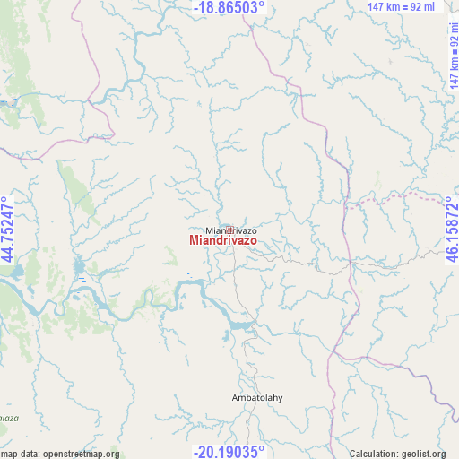
Miandrivazo GPS coordinates[2]
19° 31' 44.58" South, 45° 27' 20.124" East
| Map corner | latitude | longitude |
|---|---|---|
| Upper-left | -18.86503°, | 44.75247° |
| Center: | -19.52905°, | 45.45559° |
| Lower-right: | -20.19035°, | 46.15872° |
| Map W x H: | 147.4×147.4 km | = 91.6×91.6mi |
| max Lat: | -12.31732° ⇑56.1% North |
| Miandrivazo: | -19.52905° |
| min Lat: | ⇓43.9% South -25.3° |
| min Long | Miandrivazo | max Long |
| 43.65° | 45.45559° | 50.27876° |
| W 15.4%⇐ | ⇒84.6% E |
Elevation
Elevation of Miandrivazo is 67 m = 220 ft, and this is 490.4 m = 1609 ft below average elevation for this country.
| Max E: |
1763 m = 5784 ft | 63.4% |
| Avg. | 557.4 m = 1829 ft | |
| Miandrivazo | 67 m = 220 ft | |
Min E: |
1 m = 3 ft | 36.6% |
See also: Madagascar elevation on elevation.city.
Geographical zone
Miandrivazo is located in South Torrid zone (between Equator and Tropic of Capricorn). Distance of this Southern Tropic circle is 434.5 km =270 mi to South.| Distance of | km | miles | from Miandrivazo |
|---|---|---|---|
| Equator | 2171.4 | 1349.2 | to North |
| Tropic Capricorn | 434.5 | 270 | to South |
| Antarctic Circle | 5229.7 | 3249.6 | to South |
| South Pole | 7835.6 | 4868.8 | to South |


Nearby cities:
15 places around Miandrivazo: (largest is in red/bold)
• Ambatofinandrahana
181.1 km =112.5 mi,  128°
128°
• Antanifotsy
195.4 km =121.4 mi,  93°
93°
• Antsampanimahazo
178.6 km =111 mi, 93°
• Antsirabe
169.4 km =105.3 mi,  102°
102°
• Arivonimamo
190.1 km =118.1 mi,  72°
72°
• Belo sur Tsiribihina
97.1 km =60.3 mi,  258°
258°
• Betafo
149.9 km =93.1 mi, 103°
• Faratsiho
157.3 km =97.7 mi,  84°
84°
• Fenoarivo Be
168.8 km =104.9 mi,  43°
43°
• Miandrarivo
136.1 km =84.6 mi, 85°
• Miarinarivo
164.9 km =102.5 mi, 67°
• Morondava
145.9 km =90.7 mi,  234°
234°
• Soanindrariny
190.6 km =118.4 mi, 102°
• Soavinandriana
140 km =87 mi, 73°
• Tsiroanomandidy
104.8 km =65.1 mi, 36°
Sources, notices
• [Note1] Compared only with cities in Madagascar existing in our database
• [Src1] Map data: © OpenStreetMap contributors (CC-BY-SA)
• [Src2] Other city data from geonames.org with taken over terms of usage.
• [Src3] Geographical zone / Annual Mean Temperature by Robert A. Rohde @ Wikipedia
