Fenoarivo Be geodata
Fenoarivo Be (Bongolava) is a populated place; located in Madagascar in Indian/Antananarivo (GMT+3) time zone. With population of 19,605 people, there are 68 cities with bigger population in this country. Compared to other cities in Madagascar, 65.9% of cities are located further ↓South; 76.4% of cities are located further →East and 70.7% of cities have lower elevation than Fenoarivo Be. Note1
Administrative division(s):
- Level 1: Bongolava
- Level 2: Fenoarivobe
- Level 3: Fenoarivo Centre
- Level 4: Ambohitsaratelo


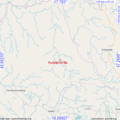
Fenoarivo Be GPS coordinates[2]
18° 25' 59.988" South, 46° 34' 0.012" East
| Map corner | latitude | longitude |
|---|---|---|
| Upper-left | -17.765°, | 45.86355° |
| Center: | -18.43333°, | 46.56667° |
| Lower-right: | -19.09907°, | 47.2698° |
| Map W x H: | 148.3×148.3 km | = 92.1×92.1mi |
| max Lat: | -12.31732° ⇑34.1% North |
| Fenoarivo Be: | -18.43333° |
| min Lat: | ⇓65.9% South -25.3° |
| min Long | Fenoarivo Be | max Long |
| 43.65° | 46.56667° | 50.27876° |
| W 23.6%⇐ | ⇒76.4% E |
Elevation
Elevation of Fenoarivo Be is 983 m = 3225 ft, and this is 425.6 m = 1396 ft above average elevation for this country.
| Max E: |
1763 m = 5784 ft | 29.3% |
| Fenoarivo Be | 983 m 3225 ft | |
| Avg. | 557.4 m = 1829 ft | |
Min E: |
1 m = 3 ft | 70.7% |
See also: Madagascar elevation on elevation.city.
Geographical zone
Fenoarivo Be is located in South Torrid zone (between Equator and Tropic of Capricorn). Distance of this Southern Tropic circle is 556.3 km =345.7 mi to South.| Distance of | km | miles | from Fenoarivo Be |
|---|---|---|---|
| Equator | 2049.6 | 1273.6 | to North |
| Tropic Capricorn | 556.3 | 345.7 | to South |
| Antarctic Circle | 5351.6 | 3325.3 | to South |
| South Pole | 7957.5 | 4944.6 | to South |


Nearby cities:
15 places around Fenoarivo Be: (largest is in red/bold)
• Alarobia
136.4 km =84.8 mi,  115°
115°
• Ambohitrolomahitsy
121.4 km =75.4 mi,  104°
104°
• Ambohitseheno
135.7 km =84.3 mi,  106°
106°
• Anjepy
129.7 km =80.6 mi, 110°
• Ankazobe
59.5 km =37 mi,  77°
77°
• Ankazondandy
131.6 km =81.8 mi, 103°
• Antananarivo
115.2 km =71.6 mi, 117°
• Arivonimamo
91.8 km =57 mi,  134°
134°
• Faratsiho
114.8 km =71.3 mi,  159°
159°
• Miandrarivo
112.8 km =70.1 mi,  170°
170°
• Miarinarivo
68.5 km =42.6 mi,  148°
148°
• Nandihizana
131.8 km =81.9 mi, 113°
• Sadabe
121.5 km =75.5 mi, 100°
• Soavinandriana
83.4 km =51.8 mi, 167°
• Tsiroanomandidy
66.4 km =41.3 mi,  235°
235°
Sources, notices
• [Note1] Compared only with cities in Madagascar existing in our database
• [Src1] Map data: © OpenStreetMap contributors (CC-BY-SA)
• [Src2] Other city data from geonames.org with taken over terms of usage.
• [Src3] Geographical zone / Annual Mean Temperature by Robert A. Rohde @ Wikipedia
