Ankazobe geodata
Ankazobe (Analamanga) is a populated place; located in Madagascar in Indian/Antananarivo (GMT+3) time zone. With population of 15,722 people, there are 82 cities with bigger population in this country. Compared to other cities in Madagascar, 67.5% of cities are located further ↓South; 64.2% of cities are located further →East and 74.8% of cities have lower elevation than Ankazobe. Note1
Administrative division(s):
- Level 1: Analamanga
- Level 2: Ankazobe District
- Level 3: Ankazobe
- Level 4: Ankazobe I


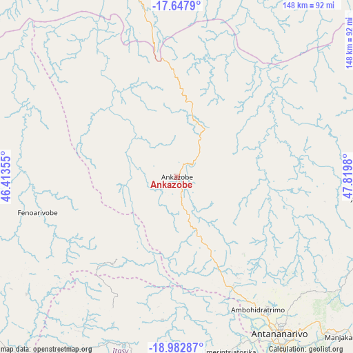
Ankazobe GPS coordinates[2]
18° 19' 0.012" South, 47° 7' 0.012" East
| Map corner | latitude | longitude |
|---|---|---|
| Upper-left | -17.6479°, | 46.41355° |
| Center: | -18.31667°, | 47.11667° |
| Lower-right: | -18.98287°, | 47.8198° |
| Map W x H: | 148.4×148.4 km | = 92.2×92.2mi |
| max Lat: | -12.31732° ⇑32.5% North |
| Ankazobe: | -18.31667° |
| min Lat: | ⇓67.5% South -25.3° |
| min Long | Ankazobe | max Long |
| 43.65° | 47.11667° | 50.27876° |
| W 35.8%⇐ | ⇒64.2% E |
Elevation
Elevation of Ankazobe is 1231 m = 4039 ft, and this is 673.6 m = 2210 ft above average elevation for this country.
| Max E: |
1763 m = 5784 ft | 25.2% |
| Ankazobe | 1231 m 4039 ft | |
| Avg. | 557.4 m = 1829 ft | |
Min E: |
1 m = 3 ft | 74.8% |
See also: Madagascar elevation on elevation.city.
Geographical zone
Ankazobe is located in South Torrid zone (between Equator and Tropic of Capricorn). Distance of this Southern Tropic circle is 569.3 km =353.7 mi to South.| Distance of | km | miles | from Ankazobe |
|---|---|---|---|
| Equator | 2036.6 | 1265.5 | to North |
| Tropic Capricorn | 569.3 | 353.7 | to South |
| Antarctic Circle | 5364.6 | 3333.4 | to South |
| South Pole | 7970.4 | 4952.6 | to South |


Nearby cities:
15 places around Ankazobe: (largest is in red/bold)
• Alarobia
97.2 km =60.4 mi,  138°
138°
• Ambohitrolomahitsy
73.4 km =45.6 mi,  125°
125°
• Ambohitseheno
88.8 km =55.2 mi, 125°
• Anjepy
86.7 km =53.9 mi, 133°
• Anjozorobe
79.7 km =49.5 mi,  96°
96°
• Ankazondandy
82.2 km =51.1 mi,  121°
121°
• Antananarivo
79.7 km =49.5 mi,  146°
146°
• Arivonimamo
78.1 km =48.5 mi,  174°
174°
• Fenoarivo Be
59.5 km =37 mi,  257°
257°
• Manjakandriana
98.2 km =61 mi, 132°
• Miarinarivo
74.8 km =46.5 mi,  197°
197°
• Nandihizana
90.6 km =56.3 mi, 135°
• Sadabe
70.9 km =44.1 mi, 119°
• Sambaina
95.6 km =59.4 mi, 132°
• Soavinandriana
102.8 km =63.9 mi, 203°
Sources, notices
• [Note1] Compared only with cities in Madagascar existing in our database
• [Src1] Map data: © OpenStreetMap contributors (CC-BY-SA)
• [Src2] Other city data from geonames.org with taken over terms of usage.
• [Src3] Geographical zone / Annual Mean Temperature by Robert A. Rohde @ Wikipedia
