Terre Rouge geodata
Terre Rouge (Pamplemousses) is a populated place; located in Mauritius in Indian/Mauritius (GMT+4) time zone. With population of 9,566 people, there are 23 cities with bigger population in this country. Compared to other cities in Mauritius, 73.7% of cities are located further ↓South; 74.7% of cities are located further →East and 77.8% of cities have higher elevation than Terre Rouge. Note1


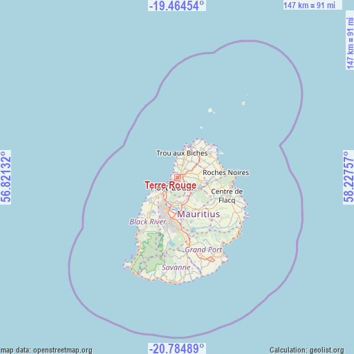
Terre Rouge GPS coordinates[2]
20° 7' 33.996" South, 57° 31' 27.984" East
| Map corner | latitude | longitude |
|---|---|---|
| Upper-left | -19.46454°, | 56.82132° |
| Center: | -20.12611°, | 57.52444° |
| Lower-right: | -20.78489°, | 58.22757° |
| Map W x H: | 146.8×146.8 km | = 91.2×91.2mi |
| max Lat: | -10.38803° ⇑26.3% North |
| Terre Rouge: | -20.12611° |
| min Lat: | ⇓73.7% South -20.51667° |
| min Long | Terre Rouge | max Long |
| 56.61795° | 57.52444° | 63.41667° |
| W 25.3%⇐ | ⇒74.7% E |
Elevation
Elevation of Terre Rouge is 40 m = 131 ft, and this is 112.1 m = 368 ft below average elevation for this country.
| Max E: |
467 m = 1532 ft | 77.8% |
| Avg. | 152.1 m = 499 ft | |
| Terre Rouge | 40 m = 131 ft | |
Min E: |
1 m = 3 ft | 22.2% |
See also: Mauritius elevation on elevation.city.
Geographical zone
Terre Rouge is located in South Torrid zone (between Equator and Tropic of Capricorn). Distance of this Southern Tropic circle is 368.1 km =228.7 mi to South.| Distance of | km | miles | from Terre Rouge |
|---|---|---|---|
| Equator | 2237.8 | 1390.5 | to North |
| Tropic Capricorn | 368.1 | 228.7 | to South |
| Antarctic Circle | 5163.4 | 3208.4 | to South |
| South Pole | 7769.2 | 4827.6 | to South |


Nearby cities:
15 places around Terre Rouge: (largest is in red/bold)
• Arsenal
2.5 km =1.6 mi,  26°
26°
• Calebasses
3.5 km =2.2 mi,  62°
62°
• Congomah
7.4 km =4.6 mi,  110°
110°
• Crève Coeur
8 km =5 mi,  154°
154°
• Le Hochet
1 km =0.6 mi,  199°
199°
• Long Mountain
4.4 km =2.7 mi,  115°
115°
• Mapou
9.8 km =6.1 mi, 55°
• Morcellement Saint André
7.6 km =4.7 mi,  37°
37°
• Notre Dame
3.4 km =2.1 mi, 118°
• Pailles
8.3 km =5.2 mi,  207°
207°
• Pamplemousses
5.4 km =3.4 mi, 62°
• Plaine des Papayes
8.4 km =5.2 mi, 36°
• Pointe aux Piments
6.8 km =4.2 mi,  359°
359°
• Port Louis
4.8 km =3 mi, 213°
• Triolet
8.1 km =5 mi,  19°
19°
Sources, notices
• [Note1] Compared only with cities in Mauritius existing in our database
• [Src1] Map data: © OpenStreetMap contributors (CC-BY-SA)
• [Src2] Other city data from geonames.org with taken over terms of usage.
• [Src3] Geographical zone / Annual Mean Temperature by Robert A. Rohde @ Wikipedia
