Pointe aux Piments geodata
Pointe aux Piments (Pamplemousses) is a populated place; located in Mauritius in Indian/Mauritius (GMT+4) time zone. With population of 7,556 people, there are 31 cities with bigger population in this country. Compared to other cities in Mauritius, 85.9% of cities are located further ↓South; 75.8% of cities are located further →East and 62.6% of cities have lower elevation than Pointe aux Piments. Note1


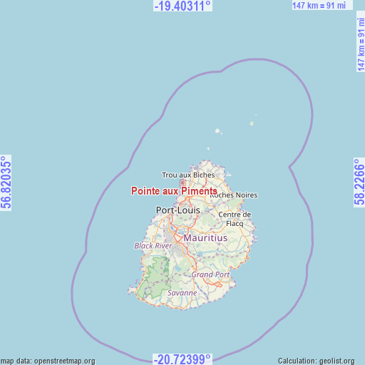
Pointe aux Piments GPS coordinates[2]
20° 3' 53.784" South, 57° 31' 24.492" East
| Map corner | latitude | longitude |
|---|---|---|
| Upper-left | -19.40311°, | 56.82035° |
| Center: | -20.06494°, | 57.52347° |
| Lower-right: | -20.72399°, | 58.2266° |
| Map W x H: | 146.9×146.9 km | = 91.3×91.3mi |
| max Lat: | -10.38803° ⇑14.1% North |
| Pointe aux Piments: | -20.06494° |
| min Lat: | ⇓85.9% South -20.51667° |
| min Long | Pointe aux Pime | max Long |
| 56.61795° | 57.52347° | 63.41667° |
| W 24.2%⇐ | ⇒75.8% E |
Elevation
Elevation of Pointe aux Piments is 143 m = 469 ft, and this is 9.1 m = 30 ft below average elevation for this country.
| Max E: |
467 m = 1532 ft | 37.4% |
| Avg. | 152.1 m = 499 ft | |
| Pointe aux Piments | 143 m = 469 ft | |
Min E: |
1 m = 3 ft | 62.6% |
See also: Mauritius elevation on elevation.city.
Geographical zone
Pointe aux Piments is located in South Torrid zone (between Equator and Tropic of Capricorn). Distance of this Southern Tropic circle is 374.9 km =233 mi to South.| Distance of | km | miles | from Pointe aux Piments |
|---|---|---|---|
| Equator | 2231 | 1386.3 | to North |
| Tropic Capricorn | 374.9 | 233 | to South |
| Antarctic Circle | 5170.2 | 3212.6 | to South |
| South Pole | 7776 | 4831.8 | to South |


Nearby cities:
15 places around Pointe aux Piments: (largest is in red/bold)
• Arsenal
4.7 km =2.9 mi,  164°
164°
• Calebasses
6.1 km =3.8 mi,  148°
148°
• Cottage
11.1 km =6.9 mi,  86°
86°
• Fond du Sac
6.6 km =4.1 mi,  72°
72°
• Grand Baie
7.9 km =4.9 mi,  48°
48°
• Le Hochet
7.8 km =4.8 mi,  181°
181°
• Long Mountain
9.6 km =6 mi, 155°
• Mapou
8.2 km =5.1 mi,  98°
98°
• Morcellement Saint André
4.8 km =3 mi, 99°
• Notre Dame
9 km =5.6 mi, 159°
• Pamplemousses
6.5 km =4 mi,  131°
131°
• Plaine des Papayes
5.1 km =3.2 mi, 90°
• Terre Rouge
6.8 km =4.2 mi, 179°
• The Vale
9.1 km =5.7 mi,  64°
64°
• Triolet
2.9 km =1.8 mi, 73°
Sources, notices
• [Note1] Compared only with cities in Mauritius existing in our database
• [Src1] Map data: © OpenStreetMap contributors (CC-BY-SA)
• [Src2] Other city data from geonames.org with taken over terms of usage.
• [Src3] Geographical zone / Annual Mean Temperature by Robert A. Rohde @ Wikipedia
