Plaine Magnien geodata
Plaine Magnien (Grand Port) is a populated place; located in Mauritius in Indian/Mauritius (GMT+4) time zone. With population of 10,778 people, there are 17 cities with bigger population in this country. Compared to other cities in Mauritius, 92.9% of cities are located further ↑North; 74.7% of cities are located further ←West and 62.6% of cities have higher elevation than Plaine Magnien. Note1


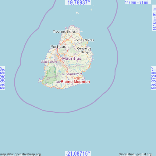
Plaine Magnien GPS coordinates[2]
20° 25' 46.812" South, 57° 40' 10.848" East
| Map corner | latitude | longitude |
|---|---|---|
| Upper-left | -19.76937°, | 56.96656° |
| Center: | -20.42967°, | 57.66968° |
| Lower-right: | -21.08715°, | 58.37281° |
| Map W x H: | 146.5×146.5 km | = 91×91mi |
| max Lat: | -10.38803° ⇑92.9% North |
| Plaine Magnien: | -20.42967° |
| min Lat: | ⇓7.1% South -20.51667° |
| min Long | Plaine Magnien | max Long |
| 56.61795° | 57.66968° | 63.41667° |
| W 74.7%⇐ | ⇒25.3% E |
Elevation
Elevation of Plaine Magnien is 67 m = 220 ft, and this is 85.1 m = 279 ft below average elevation for this country.
| Max E: |
467 m = 1532 ft | 62.6% |
| Avg. | 152.1 m = 499 ft | |
| Plaine Magnien | 67 m = 220 ft | |
Min E: |
1 m = 3 ft | 37.4% |
See also: Mauritius elevation on elevation.city.
Geographical zone
Plaine Magnien is located in South Torrid zone (between Equator and Tropic of Capricorn). Distance of this Southern Tropic circle is 334.4 km =207.8 mi to South.| Distance of | km | miles | from Plaine Magnien |
|---|---|---|---|
| Equator | 2271.6 | 1411.5 | to North |
| Tropic Capricorn | 334.4 | 207.8 | to South |
| Antarctic Circle | 5129.6 | 3187.4 | to South |
| South Pole | 7735.5 | 4806.6 | to South |


Nearby cities:
15 places around Plaine Magnien: (largest is in red/bold)
• Bambous Virieux
13.3 km =8.3 mi,  43°
43°
• Bananes
12.5 km =7.8 mi,  317°
317°
• Beau Vallon
2.9 km =1.8 mi,  65°
65°
• Bois des Amourettes
9.8 km =6.1 mi, 40°
• Camp Diable
10.2 km =6.3 mi,  248°
248°
• Cluny
9.8 km =6.1 mi, 315°
• Grand Bois
13.1 km =8.1 mi,  275°
275°
• Mahébourg
4 km =2.5 mi,  52°
52°
• New Grove
6.3 km =3.9 mi,  291°
291°
• Nouvelle France
13.1 km =8.1 mi,  300°
300°
• Rivière des Anguilles
13.8 km =8.6 mi,  243°
243°
• Rose Belle
8.3 km =5.2 mi, 293°
• Saint Aubin
14.5 km =9 mi, 239°
• Saint Hubert
8 km =5 mi,  335°
335°
• Sebastopol
15.6 km =9.7 mi,  6°
6°
Sources, notices
• [Note1] Compared only with cities in Mauritius existing in our database
• [Src1] Map data: © OpenStreetMap contributors (CC-BY-SA)
• [Src2] Other city data from geonames.org with taken over terms of usage.
• [Src3] Geographical zone / Annual Mean Temperature by Robert A. Rohde @ Wikipedia
