Melrose geodata
Melrose (Moka) is a populated place; located in Mauritius in Indian/Mauritius (GMT+4) time zone. With population of 2,002 people, there are 86 cities with bigger population in this country. Compared to other cities in Mauritius, 64.6% of cities are located further ↑North; 61.6% of cities are located further ←West and 85.9% of cities have lower elevation than Melrose. Note1


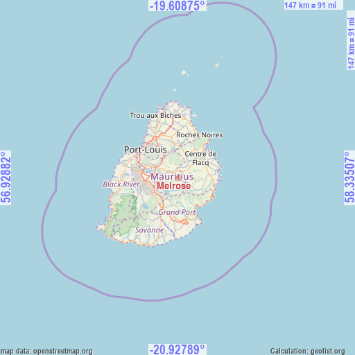
Melrose GPS coordinates[2]
20° 16' 10.992" South, 57° 37' 54.984" East
| Map corner | latitude | longitude |
|---|---|---|
| Upper-left | -19.60875°, | 56.92882° |
| Center: | -20.26972°, | 57.63194° |
| Lower-right: | -20.92789°, | 58.33507° |
| Map W x H: | 146.7×146.7 km | = 91.2×91.2mi |
| max Lat: | -10.38803° ⇑64.6% North |
| Melrose: | -20.26972° |
| min Lat: | ⇓35.4% South -20.51667° |
| min Long | Melrose | max Long |
| 56.61795° | 57.63194° | 63.41667° |
| W 61.6%⇐ | ⇒38.4% E |
Elevation
Elevation of Melrose is 346 m = 1135 ft, and this is 193.9 m = 636 ft above average elevation for this country.
| Max E: |
467 m = 1532 ft | 14.1% |
| Melrose | 346 m 1135 ft | |
| Avg. | 152.1 m = 499 ft | |
Min E: |
1 m = 3 ft | 85.9% |
See also: Mauritius elevation on elevation.city.
Geographical zone
Melrose is located in South Torrid zone (between Equator and Tropic of Capricorn). Distance of this Southern Tropic circle is 352.1 km =218.8 mi to South.| Distance of | km | miles | from Melrose |
|---|---|---|---|
| Equator | 2253.8 | 1400.4 | to North |
| Tropic Capricorn | 352.1 | 218.8 | to South |
| Antarctic Circle | 5147.4 | 3198.4 | to South |
| South Pole | 7753.3 | 4817.7 | to South |


Nearby cities:
15 places around Melrose: (largest is in red/bold)
• Bananes
9.7 km =6 mi,  207°
207°
• Camp Thorel
6.3 km =3.9 mi,  344°
344°
• Camp de Masque
4.9 km =3 mi,  41°
41°
• Clémencia
7.8 km =4.8 mi,  85°
85°
• Dagotière
7.8 km =4.8 mi,  290°
290°
• Dubreuil
4.9 km =3 mi,  224°
224°
• Lalmatie
9.4 km =5.8 mi,  18°
18°
• Midlands
8.5 km =5.3 mi,  229°
229°
• Montagne Blanche
3.3 km =2.1 mi,  122°
122°
• Providence
3.5 km =2.2 mi,  323°
323°
• Quartier Militaire
4.3 km =2.7 mi,  303°
303°
• Queen Victoria
9.6 km =6 mi,  54°
54°
• Saint Julien
4.8 km =3 mi,  5°
5°
• Sebastopol
6.3 km =3.9 mi,  111°
111°
• Verdun
9 km =5.6 mi, 296°
Sources, notices
• [Note1] Compared only with cities in Mauritius existing in our database
• [Src1] Map data: © OpenStreetMap contributors (CC-BY-SA)
• [Src2] Other city data from geonames.org with taken over terms of usage.
• [Src3] Geographical zone / Annual Mean Temperature by Robert A. Rohde @ Wikipedia
