Xicoténcatl geodata
Xicoténcatl (Tamaulipas) is a seat of a second-order administrative division; located in Mexico in America/Monterrey (GMT-6) time zone. With population of 9,593 people, there are 999 cities with bigger population in this country. Compared to other cities in Mexico, 88% of cities are located further ↓South; 51.2% of cities are located further ←West and 80% of cities have higher elevation than Xicoténcatl. Note1


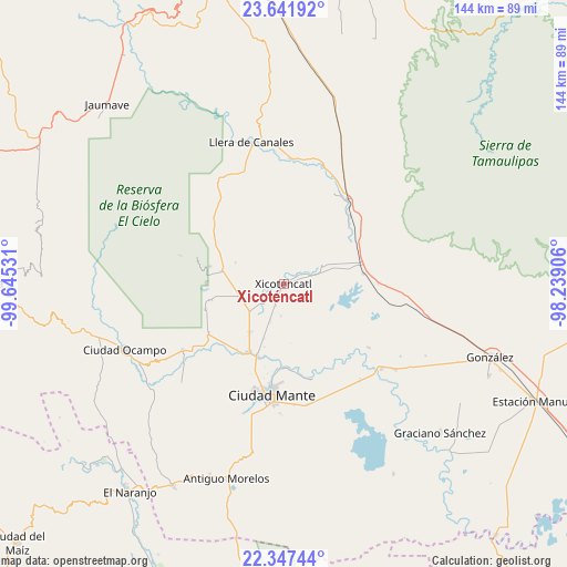
Xicoténcatl GPS coordinates[2]
22° 59' 46.428" North, 98° 56' 31.848" West
| Map corner | latitude | longitude |
|---|---|---|
| Upper-left | 23.64192°, | -99.64531° |
| Center: | 22.99623°, | -98.94218° |
| Lower-right: | 22.34744°, | -98.23906° |
| Map W x H: | 143.9×143.9 km | = 89.4×89.4mi |
| max Lat: | 32.7° ⇑12% North |
| Xicoténcatl: | 22.99623° |
| min Lat: | ⇓88% South 14.53588° |
| min Long | Xicoténcatl | max Long |
| -117.105° | -98.94218° | -86.73105° |
| W 51.2%⇐ | ⇒48.8% E |
Elevation
Elevation of Xicoténcatl is 95 m = 312 ft, and this is 1158.7 m = 3802 ft below average elevation for this country.
| Max E: |
3497 m = 11473 ft | 80% |
| Avg. | 1253.7 m = 4113 ft | |
| Xicoténcatl | 95 m = 312 ft | |
Min E: |
-1 m = -3 ft | 20% |
See also: Mexico elevation on elevation.city.
Geographical zone
Xicoténcatl is located in North Torrid zone (between Equator and Tropic of Cancer). Distance of this Northern Tropic circle is 49 km =30.4 mi to North.| Distance of | km | miles | from Xicoténcatl |
|---|---|---|---|
| North Pole | 7450.1 | 4629.3 | to North |
| Arctic Circle | 4844.2 | 3010 | to North |
| Tropic Cancer | 49 | 30.4 | to North |
| Equator | 2556.9 | 1588.8 | to South |


Nearby cities:
15 places around Xicoténcatl: (largest is in red/bold)
• Adolfo López Mateos
30.8 km =19.1 mi,  236°
236°
• Casa del Campesino
31.2 km =19.4 mi,  18°
18°
• Ciudad Mante
28.3 km =17.6 mi,  186°
186°
• El Limón
20.1 km =12.5 mi,  198°
198°
• El Nuevo Encino (El Encino)
23.6 km =14.7 mi,  312°
312°
• Emiliano Zapata
6.8 km =4.2 mi,  61°
61°
• Emiliano Zapata
30.9 km =19.2 mi,  175°
175°
• Emiliano Zapata
31.7 km =19.7 mi,  3°
3°
• Gomez Farias
21.7 km =13.5 mi,  281°
281°
• Gómez Farías
15.2 km =9.4 mi,  214°
214°
• Ignacio Zaragoza
26.7 km =16.6 mi,  36°
36°
• Mártires de Río Blanco
19.5 km =12.1 mi, 199°
• Primero de Mayo
4 km =2.5 mi, 191°
• Segunda Unidad Xicoténcatl
7.3 km =4.5 mi,  72°
72°
• Venustiano Carranza Dos
27 km =16.8 mi,  126°
126°
Sources, notices
• [Note1] Compared only with cities in Mexico existing in our database
• [Src1] Map data: © OpenStreetMap contributors (CC-BY-SA)
• [Src2] Other city data from geonames.org with taken over terms of usage.
• [Src3] Geographical zone / Annual Mean Temperature by Robert A. Rohde @ Wikipedia
