Segunda Unidad Xicoténcatl geodata
Segunda Unidad Xicoténcatl (Tamaulipas) is a populated place; located in Mexico in America/Monterrey (GMT-6) time zone. With population of 854 people, there are 10250 cities with bigger population in this country. Compared to other cities in Mexico, 88.1% of cities are located further ↓South; 52.4% of cities are located further ←West and 79% of cities have higher elevation than Segunda Unidad Xicoténcatl. Note1
Current local time in Segunda Unidad Xicoténcatl:
08:28 AM, WednesdayDifference from your time zone: hours


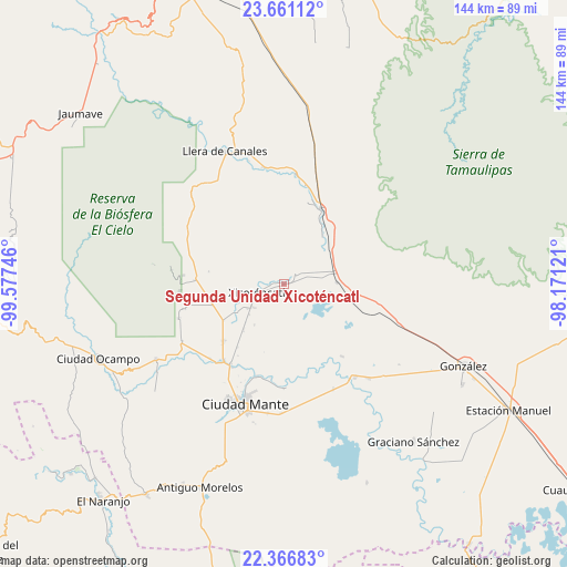
Segunda Unidad Xicoténcatl GPS coordinates[2]
23° 0' 55.908" North, 98° 52' 27.588" West
| Map corner | latitude | longitude |
|---|---|---|
| Upper-left | 23.66112°, | -99.57746° |
| Center: | 23.01553°, | -98.87433° |
| Lower-right: | 22.36683°, | -98.17121° |
| Map W x H: | 143.9×143.9 km | = 89.4×89.4mi |
| max Lat: | 32.7° ⇑11.9% North |
| Segunda Unidad Xicoténcatl: | 23.01553° |
| min Lat: | ⇓88.1% South 14.53588° |
| min Long | Segunda Unidad | max Long |
| -117.105° | -98.87433° | -86.73105° |
| W 52.4%⇐ | ⇒47.6% E |
Elevation
Elevation of Segunda Unidad Xicoténcatl is 111 m = 364 ft, and this is 1142.7 m = 3749 ft below average elevation for this country.
| Max E: |
3497 m = 11473 ft | 79% |
| Avg. | 1253.7 m = 4113 ft | |
| Segunda Unidad Xicoténcatl | 111 m = 364 ft | |
Min E: |
-1 m = -3 ft | 21% |
See also: Mexico elevation on elevation.city.
Geographical zone
Segunda Unidad Xicoténcatl is located in North Torrid zone (between Equator and Tropic of Cancer). Distance of this Northern Tropic circle is 46.8 km =29.1 mi to North.| Distance of | km | miles | from Segunda Unidad Xicoténcatl |
|---|---|---|---|
| North Pole | 7448 | 4628 | to North |
| Arctic Circle | 4842.1 | 3008.7 | to North |
| Tropic Cancer | 46.8 | 29.1 | to North |
| Equator | 2559.1 | 1590.2 | to South |


Nearby cities:
15 places around Segunda Unidad Xicoténcatl: (largest is in red/bold)
• Casa del Campesino
27.6 km =17.1 mi,  6°
6°
• Ciudad Mante
32 km =19.9 mi,  198°
198°
• El Limón
25.1 km =15.6 mi,  212°
212°
• El Nuevo Encino (El Encino)
28.1 km =17.5 mi,  299°
299°
• Emiliano Zapata
1.4 km =0.9 mi,  316°
316°
• Emiliano Zapata
29.9 km =18.6 mi,  350°
350°
• Gomez Farias
28.3 km =17.6 mi,  274°
274°
• Gómez Farías
21.4 km =13.3 mi,  226°
226°
• Ignacio Zaragoza
21.3 km =13.2 mi,  25°
25°
• Las Compuertas
29.6 km =18.4 mi,  2°
2°
• Magiscatzin
29.7 km =18.5 mi,  142°
142°
• Mártires de Río Blanco
24.5 km =15.2 mi, 213°
• Primero de Mayo
9.9 km =6.2 mi, 231°
• Venustiano Carranza Dos
23.5 km =14.6 mi, 141°
• Xicoténcatl
7.3 km =4.5 mi,  252°
252°
Sources, notices
• [Note1] Compared only with cities in Mexico existing in our database
• [Src1] Map data: © OpenStreetMap contributors (CC-BY-SA)
• [Src2] Other city data from geonames.org with taken over terms of usage.
• [Src3] Geographical zone / Annual Mean Temperature by Robert A. Rohde @ Wikipedia
