Pemucho geodata
Pemucho (San Luis Potosí) is a populated place; located in Mexico in America/Mexico_City (GMT-6) time zone. With population of 1,187 people, there are 7318 cities with bigger population in this country. Compared to other cities in Mexico, 79.1% of cities are located further ↓South; 53.1% of cities are located further ←West and 63.4% of cities have higher elevation than Pemucho. Note1


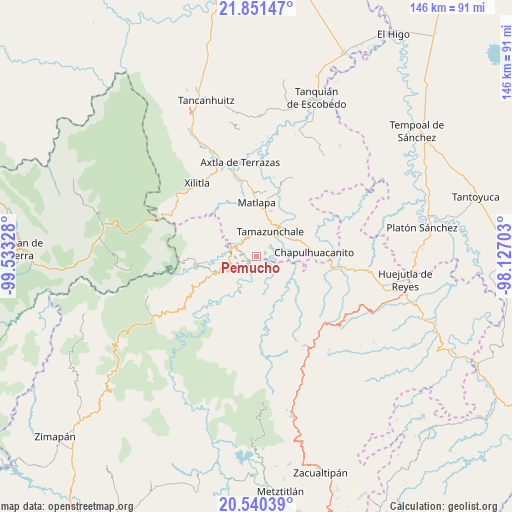
Pemucho GPS coordinates[2]
21° 11' 50.568" North, 98° 49' 48.54" West
| Map corner | latitude | longitude |
|---|---|---|
| Upper-left | 21.85147°, | -99.53328° |
| Center: | 21.19738°, | -98.83015° |
| Lower-right: | 20.54039°, | -98.12703° |
| Map W x H: | 145.8×145.8 km | = 90.6×90.6mi |
| max Lat: | 32.7° ⇑20.9% North |
| Pemucho: | 21.19738° |
| min Lat: | ⇓79.1% South 14.53588° |
| min Long | Pemucho | max Long |
| -117.105° | -98.83015° | -86.73105° |
| W 53.1%⇐ | ⇒46.9% E |
Elevation
Elevation of Pemucho is 794 m = 2605 ft, and this is 459.7 m = 1508 ft below average elevation for this country.
| Max E: |
3497 m = 11473 ft | 63.4% |
| Avg. | 1253.7 m = 4113 ft | |
| Pemucho | 794 m = 2605 ft | |
Min E: |
-1 m = -3 ft | 36.6% |
See also: Mexico elevation on elevation.city.
Geographical zone
Pemucho is located in North Torrid zone (between Equator and Tropic of Cancer). Distance of this Northern Tropic circle is 249 km =154.7 mi to North.| Distance of | km | miles | from Pemucho |
|---|---|---|---|
| North Pole | 7650.1 | 4753.6 | to North |
| Arctic Circle | 5044.2 | 3134.3 | to North |
| Tropic Cancer | 249 | 154.7 | to North |
| Equator | 2356.9 | 1464.5 | to South |


Nearby cities:
15 places around Pemucho: (largest is in red/bold)
• Amatitla Santiago
3.9 km =2.4 mi,  310°
310°
• Amatitla Tamán
4.3 km =2.7 mi,  317°
317°
• Atlajque
3.3 km =2.1 mi,  55°
55°
• Barrio Progreso
4.4 km =2.7 mi,  288°
288°
• El Carrizal
1.3 km =0.8 mi,  208°
208°
• Enramaditas
2.4 km =1.5 mi,  77°
77°
• Ixtla (Ixtla Santiago)
2.6 km =1.6 mi,  281°
281°
• Papatlaco Santiago
3.4 km =2.1 mi,  337°
337°
• Santiago Centro
3.6 km =2.2 mi, 284°
• Tamacol
4.2 km =2.6 mi,  7°
7°
• Tetitla
1.5 km =0.9 mi,  351°
351°
• Tezapotla
3.2 km =2 mi,  144°
144°
• Tixcuayuca
2.4 km =1.5 mi,  128°
128°
• Tlachiquilillacapa
2.9 km =1.8 mi,  201°
201°
• Tlalnepantla
2.5 km =1.6 mi,  220°
220°
Sources, notices
• [Note1] Compared only with cities in Mexico existing in our database
• [Src1] Map data: © OpenStreetMap contributors (CC-BY-SA)
• [Src2] Other city data from geonames.org with taken over terms of usage.
• [Src3] Geographical zone / Annual Mean Temperature by Robert A. Rohde @ Wikipedia
